File:Map Bages.png
Size of this preview: 733 × 599 pixels. Other resolutions: 294 × 240 pixels | 587 × 480 pixels | 940 × 768 pixels | 1,227 × 1,003 pixels.
Original file (1,227 × 1,003 pixels, file size: 310 KB, MIME type: image/png)
Captions
Captions
Add a one-line explanation of what this file represents
Summary edit
| Description |
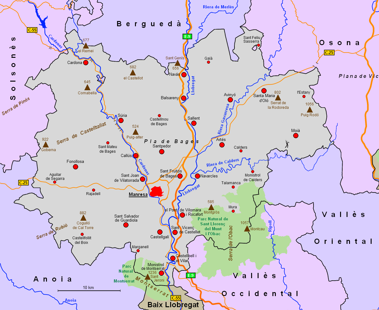
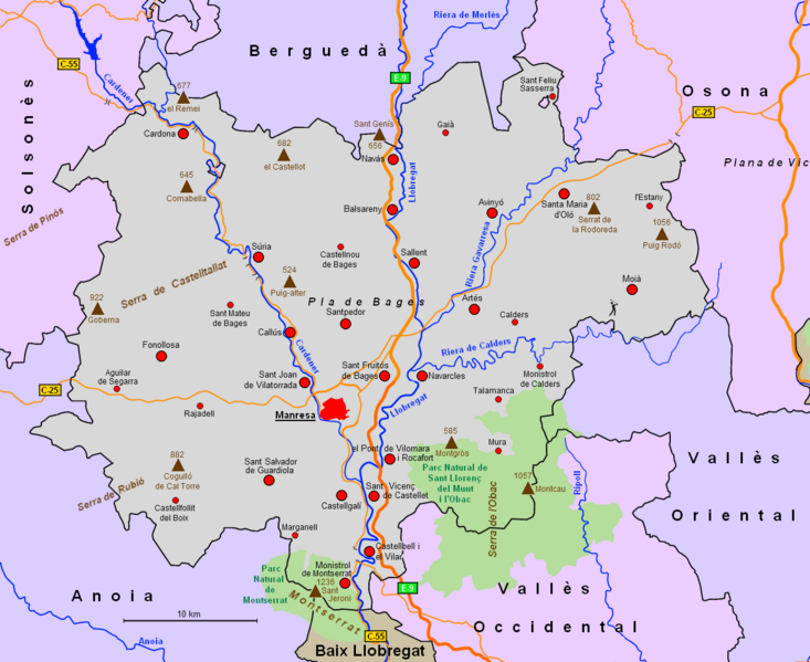
English: Map of the comarca Bages, Catalonia, Spain
Deutsch: Karte der Comarca Bages, Katalonien, Spanien
Español: Mapa de la comarca Bages, Cataluña, España |
| Date | |
| Source | Own work |
| Author | Wela49 |
Licensing edit
| I, the copyright holder of this work, release this work into the public domain. This applies worldwide. In some countries this may not be legally possible; if so: I grant anyone the right to use this work for any purpose, without any conditions, unless such conditions are required by law. |
File history
Click on a date/time to view the file as it appeared at that time.
| Date/Time | Thumbnail | Dimensions | User | Comment | |
|---|---|---|---|---|---|
| current | 18:14, 26 February 2011 | | 1,227 × 1,003 (310 KB) | Wela49~commonswiki (talk | contribs) | New Version. Neue, verbesserte Version |
| 17:48, 15 August 2010 |  | 897 × 823 (128 KB) | Wela49~commonswiki (talk | contribs) | {{Information |Description={{en|1=Map of the comarca Bages, Catalonia, Spain}} {{de|1=Karte der Comarca Bages, Katalonien, Spanien}} {{es|1=Mapa de la comarca Alta Ribagorça, Cataluña, España}} |Source={{own}} |Author=Wela49 |Date=15.08 |
You cannot overwrite this file.
File usage on Commons
There are no pages that use this file.
File usage on other wikis
The following other wikis use this file:
- Usage on de.wikipedia.org
- Usage on eu.wikipedia.org
- Aguilar de Segarra
- Balsareny
- Cardona
- Castellbell i el Vilar
- Castellfollit del Boix
- Castellnou de Bages
- Fonollosa
- Manresa
- Marganell
- Mura (Katalunia)
- Talamanca
- Artés
- Avinyó
- Callús
- Castellgalí
- Gaià
- Monistrol de Montserrat
- Navarcles
- Navàs
- El Pont de Vilomara i Rocafort
- Rajadell
- Sallent
- Sant Feliu Sasserra
- Sant Fruitós de Bages
- Sant Joan de Vilatorrada
- Sant Mateu de Bages
- Sant Salvador de Guardiola
- Sant Vicenç de Castellet
- Súria
- Santpedor
- Txantiloi:Bageseko udalerri aurkibidea