File:Map Bih entities-he.png

Size of this preview: 633 × 599 pixels. Other resolutions: 254 × 240 pixels | 507 × 480 pixels | 811 × 768 pixels | 1,103 × 1,044 pixels.
Original file (1,103 × 1,044 pixels, file size: 53 KB, MIME type: image/png)
Captions
Captions
Add a one-line explanation of what this file represents
| Description |
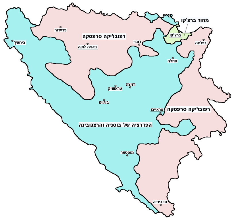
English: Federation of Bosnia and Herzegovina, Republika Srpska and Brčko district.
עברית: הפדרציה של בוסניה והרצגובינה, רפובליקה סרפסקה ומחוז ברצ'קו. |
||
| Date | |||
| Source | Image:Map Bih entities.png | ||
| Author | User:PANONIAN (translated by User:Gilado) | ||
| Permission (Reusing this file) |
|
File history
Click on a date/time to view the file as it appeared at that time.
| Date/Time | Thumbnail | Dimensions | User | Comment | |
|---|---|---|---|---|---|
| current | 14:34, 5 October 2012 | | 1,103 × 1,044 (53 KB) | PANONIAN (talk | contribs) | improved version |
| 13:02, 7 September 2009 |  | 700 × 615 (37 KB) | Gilado (talk | contribs) | {{Information |Description={{en|1=Federation of Bosnia and Herzegovina, Republika Srpska and Brčko district.}} {{he|1=הפדרציה של בוסניה והרצגובינה, רפובליקה סרפסקה ומחוז ברצ'קו.}} |Source=[[:Image:Map Bih |
You cannot overwrite this file.
File usage on Commons
The following 8 pages use this file:
.png)
File usage on other wikis
The following other wikis use this file: