File:Map CZ - district Praha-vychod.PNG

Size of this preview: 800 × 548 pixels. Other resolutions: 320 × 219 pixels | 640 × 439 pixels | 1,024 × 702 pixels | 1,281 × 878 pixels.
Original file (1,281 × 878 pixels, file size: 37 KB, MIME type: image/png)
Captions
Captions
Add a one-line explanation of what this file represents
Summary edit
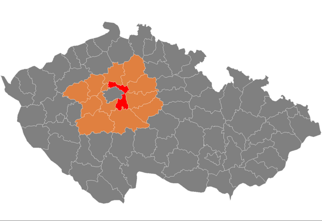
| Description | Location of Prague-East District in Central Bohemian Region and the Czech Republic. The map shows extent of the district as until December 31, 2006. |
| Date | Unknown date |
| Source | self-made, based on Image:Czech_Republic_districts.png |
| Author | Michiel1972 |
Licensing edit
| I, the copyright holder of this work, release this work into the public domain. This applies worldwide. In some countries this may not be legally possible; if so: I grant anyone the right to use this work for any purpose, without any conditions, unless such conditions are required by law. |
File history
Click on a date/time to view the file as it appeared at that time.
| Date/Time | Thumbnail | Dimensions | User | Comment | |
|---|---|---|---|---|---|
| current | 09:05, 5 October 2007 | | 1,281 × 878 (37 KB) | Michiel1972 (talk | contribs) | {{Information |Description=Locator_maps_of_districts_of_the_Czech_Republic. |Source=self-made, based on Image:Czech_Republic_districts.png |Date= |Author= Michiel1972 }} [[category:Locator_maps_of_districts_of_the_Czech_Republic |
You cannot overwrite this file.
File usage on Commons
There are no pages that use this file.
File usage on other wikis
The following other wikis use this file:
- Usage on ar.wikipedia.org
- Usage on azb.wikipedia.org
- Usage on bg.wikipedia.org
- Usage on de.wikipedia.org
- Usage on en.wikipedia.org
- Usage on eo.wikipedia.org
- Usage on fa.wikipedia.org
- Usage on fr.wikipedia.org
- Usage on hu.wikipedia.org
- Usage on it.wikipedia.org
- Usage on ka.wikipedia.org
- Usage on ms.wikipedia.org
- Usage on nl.wikipedia.org
- Usage on pl.wikipedia.org
- Usage on pnb.wikipedia.org
- Usage on pt.wikipedia.org
- Brandýs nad Labem-Stará Boleslav
- Říčany
- Čelákovice
- Predefinição:Distrito de Praha-východ
- Klecany
- Kostelec nad Černými lesy
- Mnichovice
- Odolena Voda
- Úvaly
- Lázně Toušeň
- Nehvizdy
- Škvorec
- Zápy
- Babice (Boêmia Central)
- Bašť
- Borek (Boêmia Central)
- Bořanovice
- Brázdim
- Březí (Boêmia Central)
- Černé Voděrady
- Čestlice
- Dobročovice
- Dobřejovice
- Doubek
- Dřevčice
- Dřísy
- Herink
- Hlavenec
- Horoušany
- Hovorčovice
- Hrusice
- Husinec (Boêmia Central)
- Jenštejn
- Jevany
- Jirny
View more global usage of this file.