File:Map FRG GDRsvg.svg

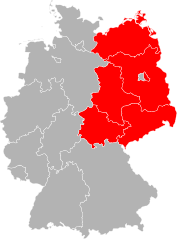
Size of this PNG preview of this SVG file: 443 × 599 pixels. Other resolutions: 177 × 240 pixels | 355 × 480 pixels | 567 × 768 pixels | 757 × 1,024 pixels | 1,513 × 2,048 pixels | 592 × 801 pixels.
Original file (SVG file, nominally 592 × 801 pixels, file size: 156 KB)
Captions
Captions
Add a one-line explanation of what this file represents
Summary edit
| Description |
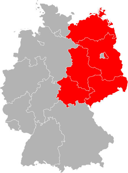
Deutsch: Karte der Bundesrepublik Deutschland mit eingezeichneten Grenzen der Bundesländer und der DDR.
English: Map of Germany divided with East Germany highlighted |
||
| Date | |||
| Source | Own work based on: Karte Bundesrepublik Deutschland.svg by David Liuzzo | ||
| Author | Marco Kaiser | ||
| SVG development | This vector image was created with Adobe Illustrator, and with Inkscape.
|
Licensing edit
I, the copyright holder of this work, hereby publish it under the following license:
This file is licensed under the Creative Commons Attribution-Share Alike 2.0 Germany license.
- You are free:
- to share – to copy, distribute and transmit the work
- to remix – to adapt the work
- Under the following conditions:
- attribution – You must give appropriate credit, provide a link to the license, and indicate if changes were made. You may do so in any reasonable manner, but not in any way that suggests the licensor endorses you or your use.
- share alike – If you remix, transform, or build upon the material, you must distribute your contributions under the same or compatible license as the original.

Original upload log edit
This image is a derivative work of the following images:
- File:Karte Bundesrepublik Deutschland.svg licensed with Cc-by-sa-2.0-de
- 2006-10-14T16:59:46Z David Liuzzo 592x801 (110986 Bytes) {{Information| |Description= {{de|Karte der Bundesrepublik Deutschland mit eingezeichneten Grenzen der Bundesländer. |Source= Erstellt aus Material des gemeinsamen Datenangebotes aus dem gemeinsamen Portal der statistischen
Uploaded with derivativeFX
File history
Click on a date/time to view the file as it appeared at that time.
| Date/Time | Thumbnail | Dimensions | User | Comment | |
|---|---|---|---|---|---|
| current | 13:56, 6 February 2009 | | 592 × 801 (156 KB) | Marco Kaiser (talk | contribs) | {{Information |Description={{de|Karte der Bundesrepublik Deutschland mit eingezeichneten Grenzen der Bundesländer und der [[:de:[[Deutsche Demokratische Republik|DDR}}.}} |Source=*[[:File:Karte_Bundesrepublik_Deutsc |
You cannot overwrite this file.
File usage on Commons
There are no pages that use this file.
File usage on other wikis
The following other wikis use this file:
- Usage on ca.wikipedia.org
- Usage on de.wikipedia.org
- Usage on en.wikipedia.org
- Talk:East Germany
- Talk:German reunification
- Talk:Stasi
- Talk:Gregor Gysi
- Talk:Volkskammer
- Talk:Socialist Unity Party of Germany
- Talk:Uwe Johnson
- Talk:ESER
- Talk:Trabant
- Talk:Günter Schabowski
- Talk:Lists of political office-holders in East Germany
- Talk:György Lukács
- Talk:National emblem of East Germany
- Talk:Auferstanden aus Ruinen
- Talk:History of East Germany
- Talk:Bertolt Brecht
- Talk:Heiner Müller
- Talk:Erich Honecker
- Talk:Large panel system building
- Talk:.dd
- Talk:Good Bye, Lenin!
- Talk:Stefan Heym
- Talk:East Berlin
- Talk:Epic theatre
- Talk:Palace of the Republic, Berlin
- Talk:One, Two, Three
- Talk:Tear down this wall!
- Talk:Ostalgie
- Talk:Interflug
- Talk:East German mark
- Talk:Ampelmännchen
- Talk:Berliner Rundfunk
- Talk:East German uprising of 1953
- Talk:Waldemar Cierpinski
- Talk:Margot Honecker
- Talk:Forum check
- Talk:Anett Pötzsch
- Talk:Fernsehturm Berlin
- Talk:Torn Curtain
- Talk:East Germany national football team
- Talk:Inner German border
- Talk:East Germany men's national ice hockey team
- Talk:Rundfunk der DDR
- Talk:Puhdys
- Talk:Arnold Zweig
- Talk:Erich Mielke
- Talk:Deutschlandsender
View more global usage of this file.