File:Map RiviereDesRemparts.jpg
Size of this preview: 701 × 599 pixels. Other resolutions: 281 × 240 pixels | 562 × 480 pixels | 898 × 768 pixels | 1,198 × 1,024 pixels | 2,396 × 2,048 pixels | 3,047 × 2,605 pixels.
Original file (3,047 × 2,605 pixels, file size: 1.28 MB, MIME type: image/jpeg)
Captions
Captions
Add a one-line explanation of what this file represents
Summary edit
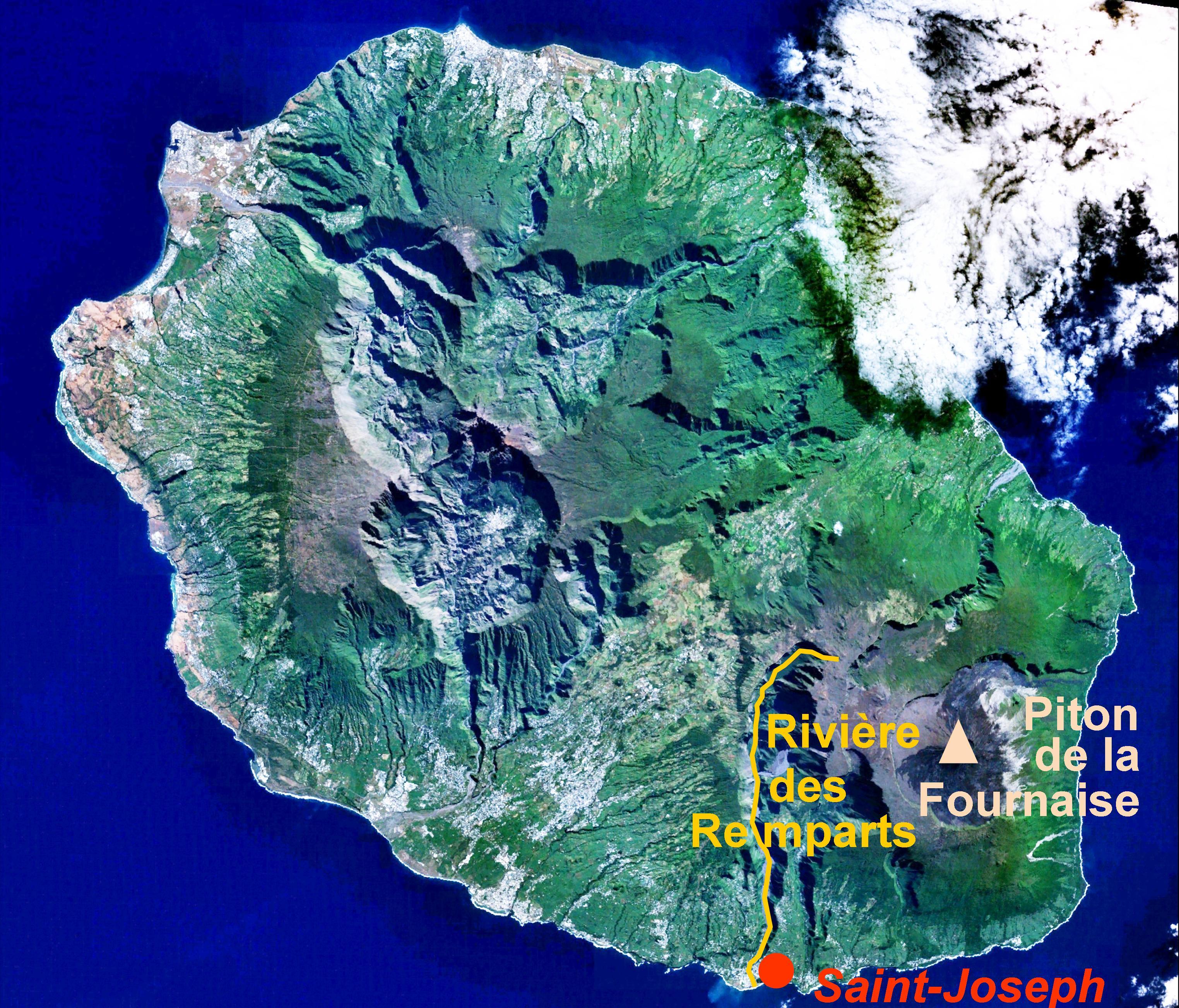
| Description | location of the Rivière des Remparts on a satellite view of Réunion island |
| Date | caption added by User:B.navez on 24 JUN 2006 |
| Source | caption added to Image:Reunion 21.12S 55.51E.jpg |
| Author | NASA |
| Permission (Reusing this file) |
PD |
Licensing edit
| This file is in the public domain in the United States because it was solely created by NASA. NASA copyright policy states that "NASA material is not protected by copyright unless noted". (See Template:PD-USGov, NASA copyright policy page or JPL Image Use Policy.) | ||
 |
Warnings:
|
File history
Click on a date/time to view the file as it appeared at that time.
| Date/Time | Thumbnail | Dimensions | User | Comment | |
|---|---|---|---|---|---|
| current | 11:40, 24 June 2006 | | 3,047 × 2,605 (1.28 MB) | B.navez (talk | contribs) | the same picture without black strips |
| 11:30, 24 June 2006 |  | 3,072 × 2,622 (1.29 MB) | B.navez (talk | contribs) | {{Information| |Description= location of the ''Rivière des Remparts'' on a satellite view of Réunion island |Source= caption added to Image:Reunion 21.12S 55.51E.jpg |Date= caption added by User:B.navez on 24 JUN 2006 |Author= NASA |Permission= |
You cannot overwrite this file.
File usage on Commons
The following page uses this file:
File usage on other wikis
The following other wikis use this file:
- Usage on ceb.wikipedia.org
- Usage on en.wikipedia.org
- Usage on fr.wikipedia.org
- Usage on www.wikidata.org