File:Map Union of Arras and Utrecht 1579-en.svg

Size of this PNG preview of this SVG file: 515 × 600 pixels. Other resolutions: 206 × 240 pixels | 412 × 480 pixels | 660 × 768 pixels | 879 × 1,024 pixels | 1,759 × 2,048 pixels | 749 × 872 pixels.
Original file (SVG file, nominally 749 × 872 pixels, file size: 140 KB)
Captions
Captions
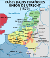
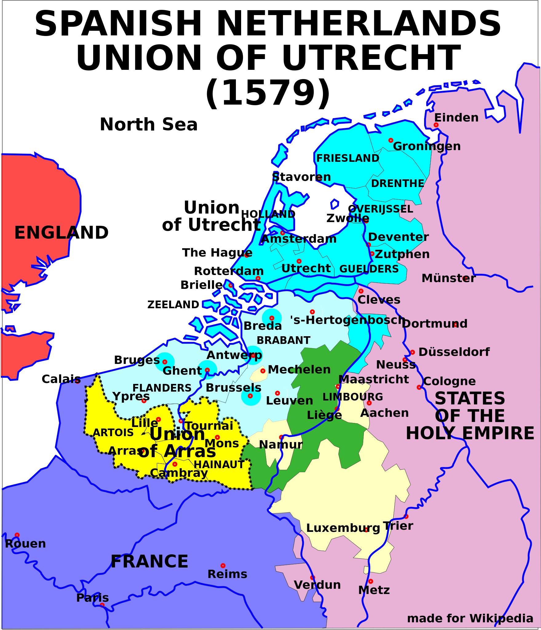
Map of the Spanish Netherlands, the Union of Utrecht and the Union of Arras (1579).
Summary edit

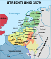
Map of the Union of Utrecht in 1579
SVG source of Image:Map-1579 Union of Utrecht.png
[]
-
 български
 -
 English
 -
 español
 -
 français (original)
 -
 magyar
 -
 galego
 -
 Nederlands
 -
 norsk
norsk


Licensing edit
This file is licensed under the Creative Commons Attribution-Share Alike 2.5 Generic license.
- You are free:
- to share – to copy, distribute and transmit the work
- to remix – to adapt the work
- Under the following conditions:
- attribution – You must give appropriate credit, provide a link to the license, and indicate if changes were made. You may do so in any reasonable manner, but not in any way that suggests the licensor endorses you or your use.
- share alike – If you remix, transform, or build upon the material, you must distribute your contributions under the same or compatible license as the original.
File history
Click on a date/time to view the file as it appeared at that time.
| Date/Time | Thumbnail | Dimensions | User | Comment | |
|---|---|---|---|---|---|
| current | 13:23, 31 May 2006 | | 749 × 872 (140 KB) | Moyogo (talk | contribs) | layers |
| 20:12, 21 September 2005 |  | 744 × 1,052 (138 KB) | Moyogo (talk | contribs) | SVG source of Image:Map-1579 Union of Utrecht.png |
You cannot overwrite this file.
File usage on Commons
The following 11 pages use this file:
- Low Countries
- File:1579 Union of Utrecht.svg (file redirect)
- File:Map Union of Arras and Utrecht 1579-bg.svg
- File:Map Union of Arras and Utrecht 1579-en.svg
- File:Map Union of Arras and Utrecht 1579-es.svg
- File:Map Union of Arras and Utrecht 1579-fr.svg
- File:Map Union of Arras and Utrecht 1579-gl.svg
- File:Map Union of Arras and Utrecht 1579-hu.svg
- File:Map Union of Arras and Utrecht 1579-nl.svg
- File:Map Union of Arras and Utrecht 1579-no.svg
- Template:Other versions/Map Union of Arras and Utrecht 1579
File usage on other wikis
The following other wikis use this file:
- Usage on cs.wikipedia.org
- Usage on de.wikipedia.org
- Usage on en.wikipedia.org
- Usage on et.wikipedia.org
- Usage on fa.wikipedia.org
- Usage on it.wikipedia.org
- Usage on ja.wikipedia.org
- Usage on ka.wikipedia.org
- Usage on ko.wikipedia.org
- Usage on ro.wikipedia.org
- Usage on sh.wikipedia.org
- Usage on sr.wikipedia.org
- Usage on th.wikipedia.org
- Usage on zh.wikipedia.org