File:Map of Alabama highlighting Perry County.svg

Size of this PNG preview of this SVG file: 379 × 600 pixels. Other resolutions: 152 × 240 pixels | 303 × 480 pixels | 485 × 768 pixels | 647 × 1,024 pixels | 1,294 × 2,048 pixels | 3,379 × 5,346 pixels.
Original file (SVG file, nominally 3,379 × 5,346 pixels, file size: 94 KB)
Captions
Captions
Add a one-line explanation of what this file represents
Summary edit
| Description |
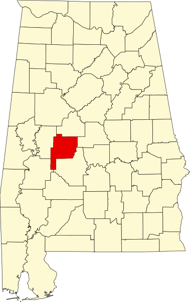
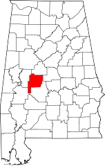
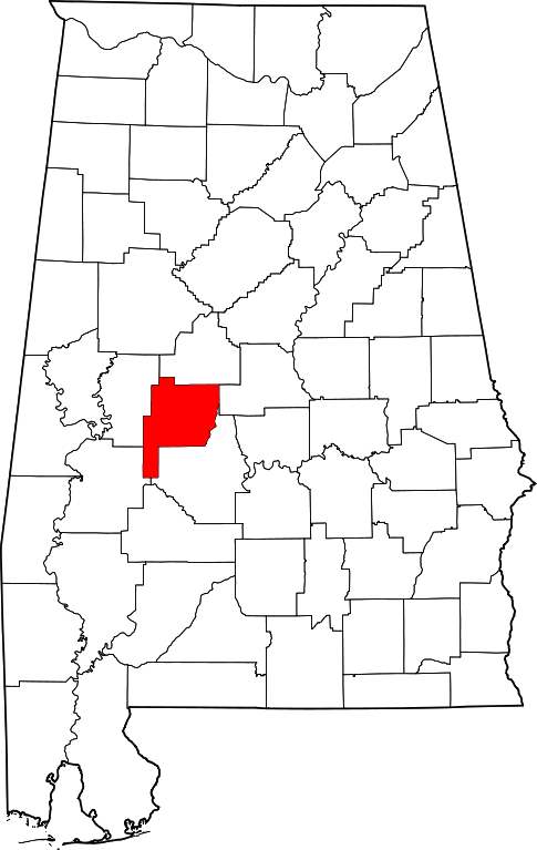
English: This is a locator map showing Perry County in Alabama. For more information, see Commons:United States county locator maps. |
| Date | |
| Source |
Own work: English: The maps use data from nationalatlas.gov, specifically countyp020.tar.gz on the Raw Data Download page. The maps also use state outline data from statesp020.tar.gz. The Florida maps use hydrogm020.tar.gz to display Lake Okeechobee. |
| Author | David Benbennick |
Licensing edit
| I, the copyright holder of this work, release this work into the public domain. This applies worldwide. In some countries this may not be legally possible; if so: I grant anyone the right to use this work for any purpose, without any conditions, unless such conditions are required by law. |
File history
Click on a date/time to view the file as it appeared at that time.
| Date/Time | Thumbnail | Dimensions | User | Comment | |
|---|---|---|---|---|---|
| current | 09:53, 12 February 2006 | | 3,379 × 5,346 (94 KB) | David Benbennick (talk | contribs) | {{subst:User:Dbenbenn/clm|county=Perry County|state=Alabama}} |
You cannot overwrite this file.
File usage on Commons
The following 6 pages use this file:
File usage on other wikis
The following other wikis use this file:
- Usage on ar.wikipedia.org
- Usage on az.wikipedia.org
- Usage on bg.wikipedia.org
- Usage on bpy.wikipedia.org
- Usage on ca.wikipedia.org
- Usage on cdo.wikipedia.org
- Usage on ceb.wikipedia.org
- Usage on ce.wikipedia.org
- Usage on cy.wikipedia.org
- Usage on de.wikipedia.org
- Usage on en.wikipedia.org
- List of counties in Alabama
- Perry County, Alabama
- Marion, Alabama
- Uniontown, Alabama
- Judson College (Alabama)
- National Register of Historic Places listings in Perry County, Alabama
- Lincoln Normal School
- Heiberger, Alabama
- Marion Military Institute
- Template:Perry County, Alabama
- Kenworthy Hall
- Pitts' Folly
- Sprott, Alabama
- User:Nyttend/County templates/AL
- Westwood (Uniontown, Alabama)
- Marion Courthouse Square Historic District
- Uniontown Historic District (Uniontown, Alabama)
- Fairhope Plantation
- Siloam Baptist Church
- Category:Populated places in Perry County, Alabama
- West Marion Historic District
- Folsom, Perry County, Alabama
- First Congregational Church of Marion
- Template:NRHP in Perry County, Alabama
- Bryand Brand House
- Moore-Webb-Holmes Plantation
- Green Street Historic District (Marion, Alabama)
- Henry House (Marion, Alabama)
- Adler, Alabama
- Augustin, Alabama
- Hamburg, Alabama
- Jericho, Alabama
- Levert, Alabama
- Morgan Springs, Alabama
- Oakmulgee, Alabama
View more global usage of this file.