File:Map of Alaska highlighting Juneau City and Borough.svg

Size of this PNG preview of this SVG file: 800 × 423 pixels. Other resolutions: 320 × 169 pixels | 640 × 338 pixels | 1,024 × 541 pixels | 1,280 × 677 pixels | 2,560 × 1,353 pixels | 1,470 × 777 pixels.
Original file (SVG file, nominally 1,470 × 777 pixels, file size: 338 KB)
Captions
Captions
Add a one-line explanation of what this file represents
Summary edit
| Description |
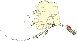
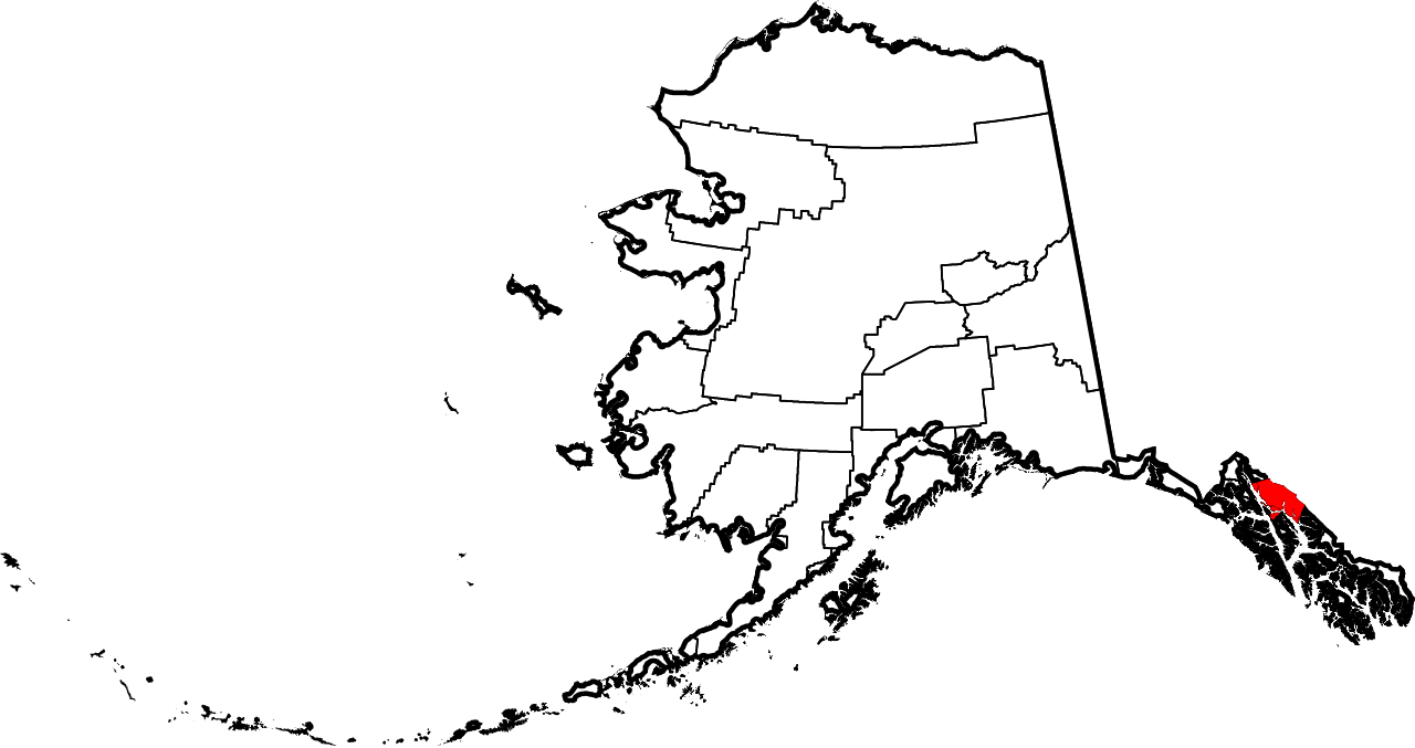
English: This is a locator map showing Juneau City and Borough in Alaska |
| Date | |
| Source |
Own work: English: The maps use data from nationalatlas.gov, specifically countyp020.tar.gz on the Raw Data Download page. The maps also use state outline data from statesp020.tar.gz. The Florida maps use hydrogm020.tar.gz to display Lake Okeechobee. |
| Author | David Benbennick |
Licensing edit
| I, the copyright holder of this work, release this work into the public domain. This applies worldwide. In some countries this may not be legally possible; if so: I grant anyone the right to use this work for any purpose, without any conditions, unless such conditions are required by law. |
File history
Click on a date/time to view the file as it appeared at that time.
| Date/Time | Thumbnail | Dimensions | User | Comment | |
|---|---|---|---|---|---|
| current | 19:26, 5 March 2006 | | 1,470 × 777 (338 KB) | David Benbennick (talk | contribs) | {{subst:User:Dbenbenn/clm|county=Juneau City and Borough|state=Alaska|type=borough and census area}} |
You cannot overwrite this file.
File usage on Commons
There are no pages that use this file.
File usage on other wikis
The following other wikis use this file:
- Usage on bpy.wikipedia.org
- Usage on ca.wikipedia.org
- Usage on de.wikipedia.org
- Usage on en.wikipedia.org
- List of boroughs and census areas in Alaska
- Juneau Empire
- Eaglecrest Ski Area
- Stephens Passage
- Gastineau Channel
- Wikipedia:WikiProject Alaska
- Capital City Weekly
- Adair-Kennedy Memorial Park
- Mount Roberts (Alaska)
- Lincoln Island (Alaska)
- Point Sherman Light
- Sentinel Island Light
- Mendenhall Lake
- ABC Islands (Alaska)
- Red Dog Saloon
- Alaska Electric Light & Power
- Snettisham hydroelectric power plant
- Quartz Gulch
- Dipyramid (Alaska)
- Vanderbilt Reef
- Taku Harbor
- Template:JuneauAK-geo-stub
- National Register of Historic Places listings in Juneau, Alaska
- Mount Nesselrode
- Whiting River
- Auke Lake
- Kakuhan Range
- Nugget Falls
- Thunder Mountain High School
- Douglas Harbor
- Lena Beach, Juneau
- Kootznoowoo Wilderness
- Bacon Glacier
- New Boston, Juneau
- Starr Hill, Juneau
- West Juneau, Alaska
- Aaron Island (Alaska)
- Tolch Rock
- Fish Creek (Douglas Island, Juneau, Alaska)
- Tee Harbor, Juneau
- Amherst Peak
- Table Top Mountain (Juneau, Alaska)
- Mount Troy
- Ninemile Creek (Juneau, Alaska)
- Celebration (Alaska festival)
- Elevenmile Creek
View more global usage of this file.