File:Map of Antwerp around 1699 - 1706.jpg
Size of this preview: 800 × 476 pixels. Other resolutions: 320 × 190 pixels | 640 × 381 pixels | 1,024 × 609 pixels | 1,280 × 761 pixels | 2,560 × 1,522 pixels | 5,881 × 3,497 pixels.
Original file (5,881 × 3,497 pixels, file size: 11.15 MB, MIME type: image/jpeg)
Captions
Captions
Add a one-line explanation of what this file represents
Summary edit
| Description |
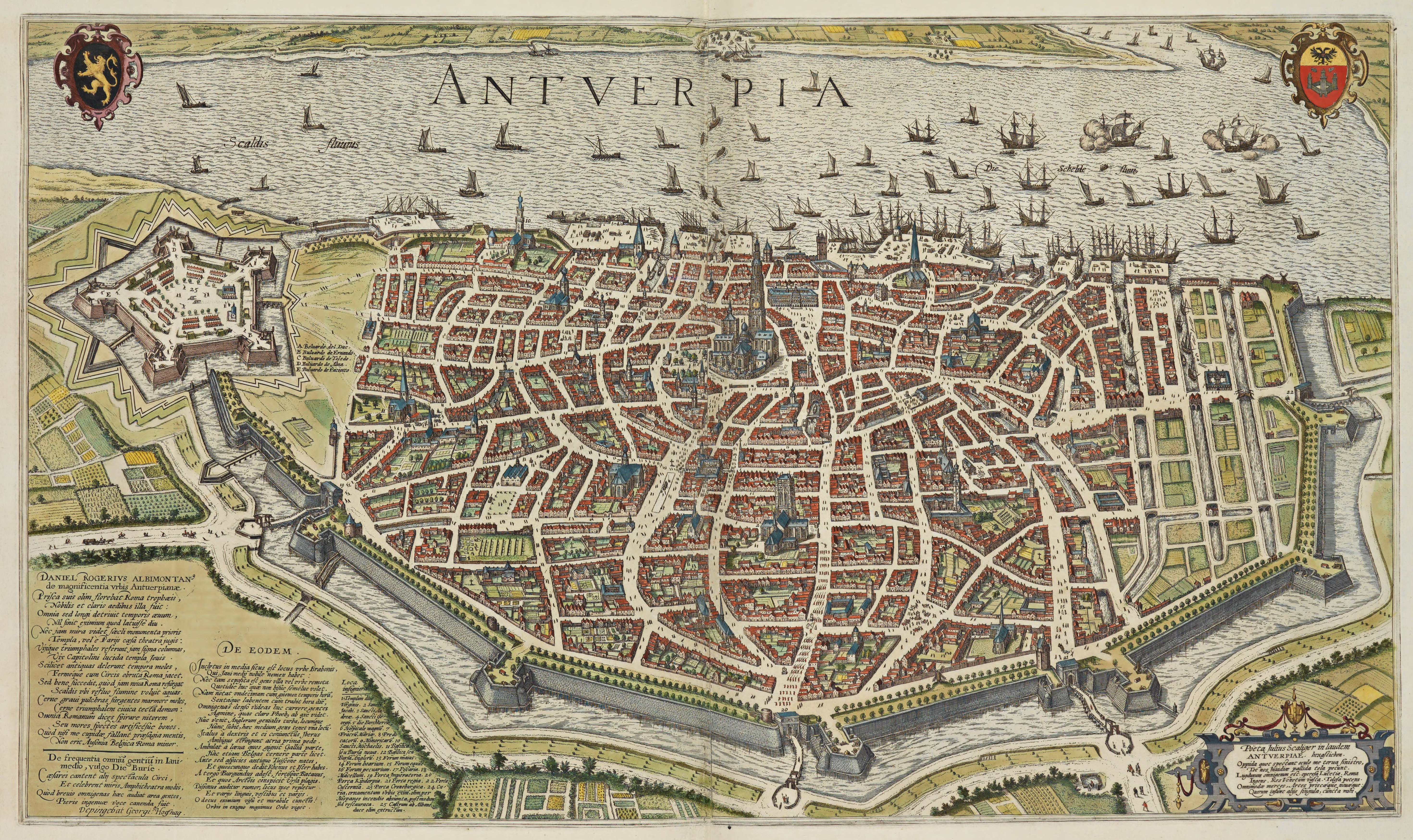
English: Map of Antwerp, publ. around 1699 - 1706.
Français : Plan d'Anvers vers 1699 - 1706.
Nederlands: Kaart van Antwerpen rond 1699 1706. |
| Date | |
| Source | Library of Congress - https://lccn.loc.gov/2021668587/ part of (Accurately Delineated Ichnographic Plans of All the Cities and Towns in the 17 Provinces of the Netherlands). |
| Author | Frederik de Wit (1630 -1706) |
Licensing edit
|
This work is in the public domain in its country of origin and other countries and areas where the copyright term is the author's life plus 70 years or fewer. This work is in the public domain in the United States because it was published (or registered with the U.S. Copyright Office) before January 1, 1929. | |
| This file has been identified as being free of known restrictions under copyright law, including all related and neighboring rights. | |
File history
Click on a date/time to view the file as it appeared at that time.
| Date/Time | Thumbnail | Dimensions | User | Comment | |
|---|---|---|---|---|---|
| current | 09:04, 6 July 2023 | | 5,881 × 3,497 (11.15 MB) | Artanisen (talk | contribs) | High resolution (same source) |
| 19:15, 28 September 2021 |  | 1,522 × 906 (568 KB) | KingBaudoin (talk | contribs) | Uploaded a work by Frederik de Wit (1630 -1706) from https://www.wdl.org/en/item/14419/ with UploadWizard |
You cannot overwrite this file.
File usage on Commons
The following page uses this file:
.jpg)
File usage on other wikis
The following other wikis use this file:
- Usage on nl.wikipedia.org