File:Map of Asia from the Interwar period, ca. 1932-36.jpg

Size of this preview: 800 × 600 pixels. Other resolutions: 320 × 240 pixels | 640 × 480 pixels | 1,024 × 768 pixels | 1,280 × 960 pixels | 1,600 × 1,200 pixels.
Original file (1,600 × 1,200 pixels, file size: 1.32 MB, MIME type: image/jpeg)
Captions
Captions
Add a one-line explanation of what this file represents
Summary edit
| Description |
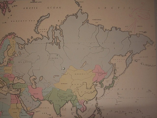
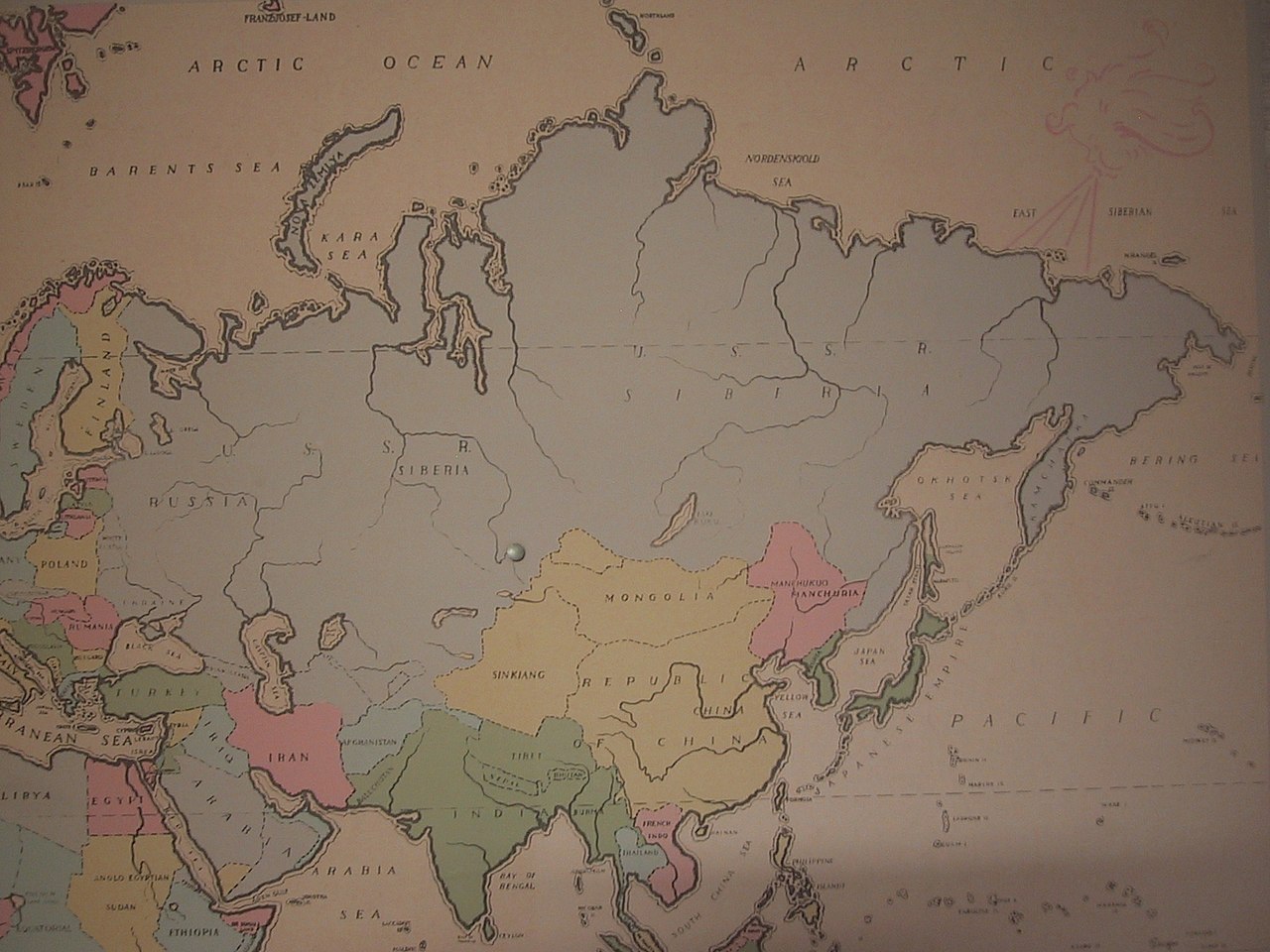
English: This is the Asian portion of an old map of the world (a Mercator projection on a plywood backing) that my old roommate's mother used when she was a schoolteacher. Judging by its inclusion of Manchukuo, and the Transcaucasian Republic in the USSR, this seems to have been made somewhere from 1932 to 1936. Note its inclusion of Tannu Tuva northwest of Mongolia (though it's inaccurately drawn--it's backwards!). The tack may have been intended to mark the location of Novosibirsk. |
| Date | |
| Source | Own work |
| Author | Lordpeyre |
Licensing edit
I, the copyright holder of this work, hereby publish it under the following license:
This file is licensed under the Creative Commons Attribution-Share Alike 3.0 Unported license.
- You are free:
- to share – to copy, distribute and transmit the work
- to remix – to adapt the work
- Under the following conditions:
- attribution – You must give appropriate credit, provide a link to the license, and indicate if changes were made. You may do so in any reasonable manner, but not in any way that suggests the licensor endorses you or your use.
- share alike – If you remix, transform, or build upon the material, you must distribute your contributions under the same or compatible license as the original.
File history
Click on a date/time to view the file as it appeared at that time.
| Date/Time | Thumbnail | Dimensions | User | Comment | |
|---|---|---|---|---|---|
| current | 16:48, 9 November 2011 | | 1,600 × 1,200 (1.32 MB) | Lordpeyre (talk | contribs) |
You cannot overwrite this file.
File usage on Commons
There are no pages that use this file.
File usage on other wikis
The following other wikis use this file:
- Usage on azb.wikipedia.org
- Usage on be-tarask.wikipedia.org
- Usage on be.wikipedia.org