File:Map of California highlighting Madera County.svg

Size of this PNG preview of this SVG file: 523 × 599 pixels. Other resolutions: 209 × 240 pixels | 419 × 480 pixels | 670 × 768 pixels | 894 × 1,024 pixels | 1,787 × 2,048 pixels | 1,022 × 1,171 pixels.
Original file (SVG file, nominally 1,022 × 1,171 pixels, file size: 506 KB)
Captions
Captions
Add a one-line explanation of what this file represents
Summary edit
| Description |
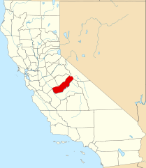
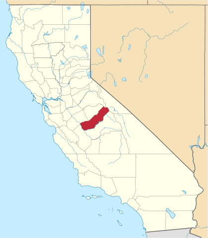
English: This is a locator map showing Madera County in California. For more information, see Commons:United States county locator maps. |
| Date | |
| Source |
Own work: English: The maps use data from nationalatlas.gov, specifically countyp020.tar.gz on the Raw Data Download page. The maps also use state outline data from statesp020.tar.gz. The Florida maps use hydrogm020.tar.gz to display Lake Okeechobee. |
| Author | David Benbennick |
Licensing edit
| I, the copyright holder of this work, release this work into the public domain. This applies worldwide. In some countries this may not be legally possible; if so: I grant anyone the right to use this work for any purpose, without any conditions, unless such conditions are required by law. |
File history
Click on a date/time to view the file as it appeared at that time.
| Date/Time | Thumbnail | Dimensions | User | Comment | |
|---|---|---|---|---|---|
| current | 18:48, 25 November 2016 | | 1,022 × 1,171 (506 KB) | Spartan7W (talk | contribs) | Update HQ map |
| 10:26, 12 February 2006 |  | 9,164 × 10,536 (229 KB) | David Benbennick (talk | contribs) | {{subst:User:Dbenbenn/clm|county=Madera County|state=California}} |
You cannot overwrite this file.
File usage on Commons
The following 10 pages use this file:
- Category:Births in Madera County, California
- Category:Geography of Madera County, California
- Category:History of Madera County, California
- Category:Madera County, California
- Category:Maps of Madera County, California
- Category:Nature of Madera County, California
- Category:People of Madera County, California
- Category:Roads in Madera County, California
- Category:Transport in Madera County, California
- Category:Wildfires in Madera County, California
File usage on other wikis
The following other wikis use this file:
- Usage on ar.wikipedia.org
- Usage on az.wikipedia.org
- Usage on ban.wikipedia.org
- Usage on bpy.wikipedia.org
- Usage on ca.wikipedia.org
- Usage on ceb.wikipedia.org
- Usage on ce.wikipedia.org
- Usage on cs.wikipedia.org
- Usage on cy.wikipedia.org
- Usage on da.wikipedia.org
- Usage on de.wikipedia.org
- Usage on en.wikipedia.org
- List of counties in California
- Madera County, California
- Bonadelle Ranchos-Madera Ranchos, California
- Chowchilla, California
- Madera, California
- Madera Acres, California
- Oakhurst, California
- Parksdale, California
- Parkwood, California
- Coarsegold, California
- Ahwahnee, California
- Bass Lake (Madera County, California)
- Template:Madera County, California
- North Fork, California
- Raymond, California
- Bass Lake, California
- Minturn, California
- Millerton, Madera County, California
- Sugar Pine, California
- Category:Wikipedia requested photographs in Madera County, California
- National Register of Historic Places listings in Madera County, California
View more global usage of this file.