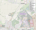
File:Map of Dachau concentration camp and cemeteries overview - english.png

Original file (3,555 × 2,963 pixels, file size: 6.95 MB, MIME type: image/png)
Captions
Captions
Summary
edit| DescriptionMap of Dachau concentration camp and cemeteries overview - english.png |
English: Map of Dachau concentration camp and cemeteries (english version), with buildings until 1945 - overview
Base for 1-35: https://commons.wikimedia.org/wiki/File:Concentration_camp_dachau_aerial_view.jpg#Summary Sites until 1945 / yellow - preserved structures 1 railtrack of Buchenwald death train, April 29, 1945 2 hospitals of SS 3 “Jourhaus”, main entry to the concentration camp with “Arbeit macht frei” 4 “Appellplatz”, roll call square 5 Würm, small river 6 watchtower B 7 “Theodor-Eicke-Platz”, a square 8 “Straße der SS”, a street 9 crematoria (old and big one, with gas chamber) 10 camp gardening 11 angora rabbit barn 12 disinfection building 12b camp brothel 13 material warehouse 14 maintenance building 15 close arrest building, called “Bunker” 16 SS residential houses 17 “Waldheim”, official residence of the camp leader 18 garages 19 SS troop barracks 20 “Holländer” hangar, storehouse and garage 21 SS sports field 21b SS swimming pool 22 penal camp of Waffen-SS and police 23 administration building 24 SS administration building 25 salary station “Waffen-SS” 26 “Kommandantur”, headquarter of the concentration camp 27 “Gestapo”, political police department 28 gas station 29 heat plant 30 SS administration school 31 “Waffentechnische Lehranstalt der SS”, armament academy 32 bakery, storehouse of “SS-Bekleidungswerke” (garment factories) 33 storehouse of SS-Bekleidungswerke 34 workshops of the Deutsche Ausrüstungs-Werke (DAW), which has been a SS corporation 35 barracks of camp guards 36 workshops army equipment office 37 porcelain manufactory (also Allach) 38 Präzifix, armament factory 39 entomological institute 40 “Deutsche Versuchsanstalt für Ernährung u. Verpflegung”, German research institute for nutrition and meals 41 “Freiland I” - work detachment “Plantage” - |
| Date | |
| Source | https://www.openstreetmap.org/#map=16/48.2727/11.4547 |
| Author |
© OpenStreetMap-Mitwirkende, openstreetmap.org, CC BY-SA 2.0. added information: former Dachau Concentration Camp (until 1945) |
| Other versions |
|
Licensing
edit- You are free:
- to share – to copy, distribute and transmit the work
- to remix – to adapt the work
- Under the following conditions:
- attribution – You must give appropriate credit, provide a link to the license, and indicate if changes were made. You may do so in any reasonable manner, but not in any way that suggests the licensor endorses you or your use.
- share alike – If you remix, transform, or build upon the material, you must distribute your contributions under the same or compatible license as the original.
File history
Click on a date/time to view the file as it appeared at that time.
| Date/Time | Thumbnail | Dimensions | User | Comment | |
|---|---|---|---|---|---|
| current | 17:09, 4 September 2022 |  | 3,555 × 2,963 (6.95 MB) | Treck08 (talk | contribs) | Small optimizations |
| 14:33, 3 September 2022 |  | 3,555 × 2,963 (6.95 MB) | Treck08 (talk | contribs) | Small optimizations and fixes | |
| 16:09, 2 September 2022 |  | 3,555 × 2,963 (6.94 MB) | Treck08 (talk | contribs) | much besser quality, lighter, same numbers and informatiion | |
| 20:38, 1 September 2022 |  | 3,000 × 1,689 (4.92 MB) | Treck08 (talk | contribs) | Uploaded a work by © OpenStreetMap-Mitwirkende, openstreetmap.org, CC BY-SA 2.0. added information: former Dachau Concentration Camp (until 1945) from https://www.openstreetmap.org/#map=16/48.2727/11.4547 with UploadWizard |
You cannot overwrite this file.
File usage on Commons
The following 6 pages use this file:
- User:Magog the Ogre/Maps of conflicts/2022 September
- File:Concentration camp dachau aerial view.jpg
- File:Dachau Gedenkstätte Aerial.jpg
- File:KZ Dachau und KZ-Friedhöfe - Lageplan Übersicht.png
- File:Map of Dachau concentration camp and cemeteries overview - english.png
- File:Map of Dachau concentration camp and cemeteries overview - without labels.png
Metadata
This file contains additional information such as Exif metadata which may have been added by the digital camera, scanner, or software program used to create or digitize it. If the file has been modified from its original state, some details such as the timestamp may not fully reflect those of the original file. The timestamp is only as accurate as the clock in the camera, and it may be completely wrong.
| Horizontal resolution | 118.11 dpc |
|---|---|
| Vertical resolution | 118.11 dpc |


