File:Map of Ferraris maps.png
Size of this preview: 800 × 524 pixels. Other resolutions: 320 × 210 pixels | 640 × 419 pixels | 928 × 608 pixels.
Original file (928 × 608 pixels, file size: 24 KB, MIME type: image/png)
Captions
Captions
Add a one-line explanation of what this file represents
Summary edit
| Description |
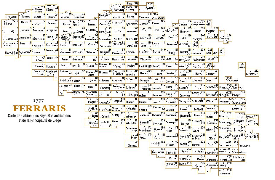
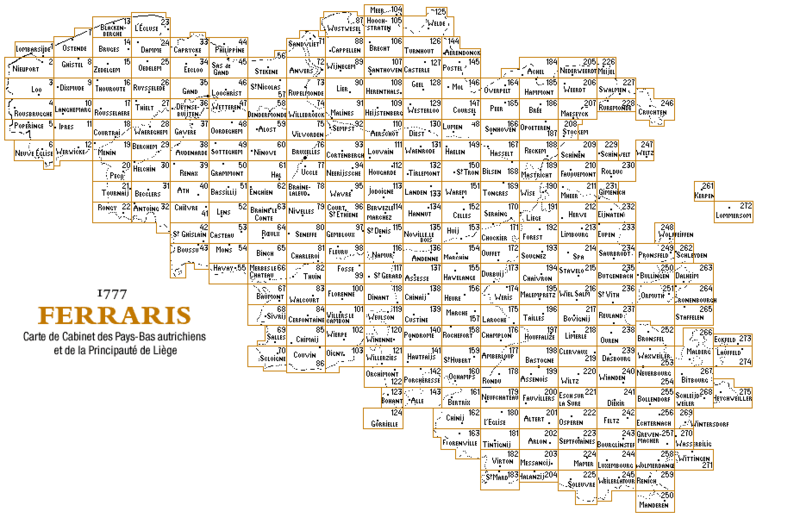
Français : Carte des cartes de Ferraris. À utiliser avec Category:Full size Ferraris maps of Belgium.
English: Maps of Ferraris maps. To be used with Category:Full size Ferraris maps of Belgium. |
| Date | |
| Source | http://www.ngi.be/FerrarisKBR/images/carte_fr.gif |
| Author | Unknown author |
Licensing edit
| This work is ineligible for copyright and therefore in the public domain because it consists entirely of information that is common property and contains no original authorship. |
File history
Click on a date/time to view the file as it appeared at that time.
| Date/Time | Thumbnail | Dimensions | User | Comment | |
|---|---|---|---|---|---|
| current | 10:52, 2 March 2019 | | 928 × 608 (24 KB) | The RedBurn (talk | contribs) | User created page with UploadWizard |
You cannot overwrite this file.
File usage on Commons
The following 3 pages use this file: