File:Map of French Polynesia-fr.svg

Size of this PNG preview of this SVG file: 600 × 600 pixels. Other resolutions: 240 × 240 pixels | 480 × 480 pixels | 768 × 768 pixels | 1,024 × 1,024 pixels | 2,048 × 2,048 pixels | 2,102 × 2,102 pixels.
Original file (SVG file, nominally 2,102 × 2,102 pixels, file size: 453 KB)
Captions
Captions
Add a one-line explanation of what this file represents
Summary edit
| Description |
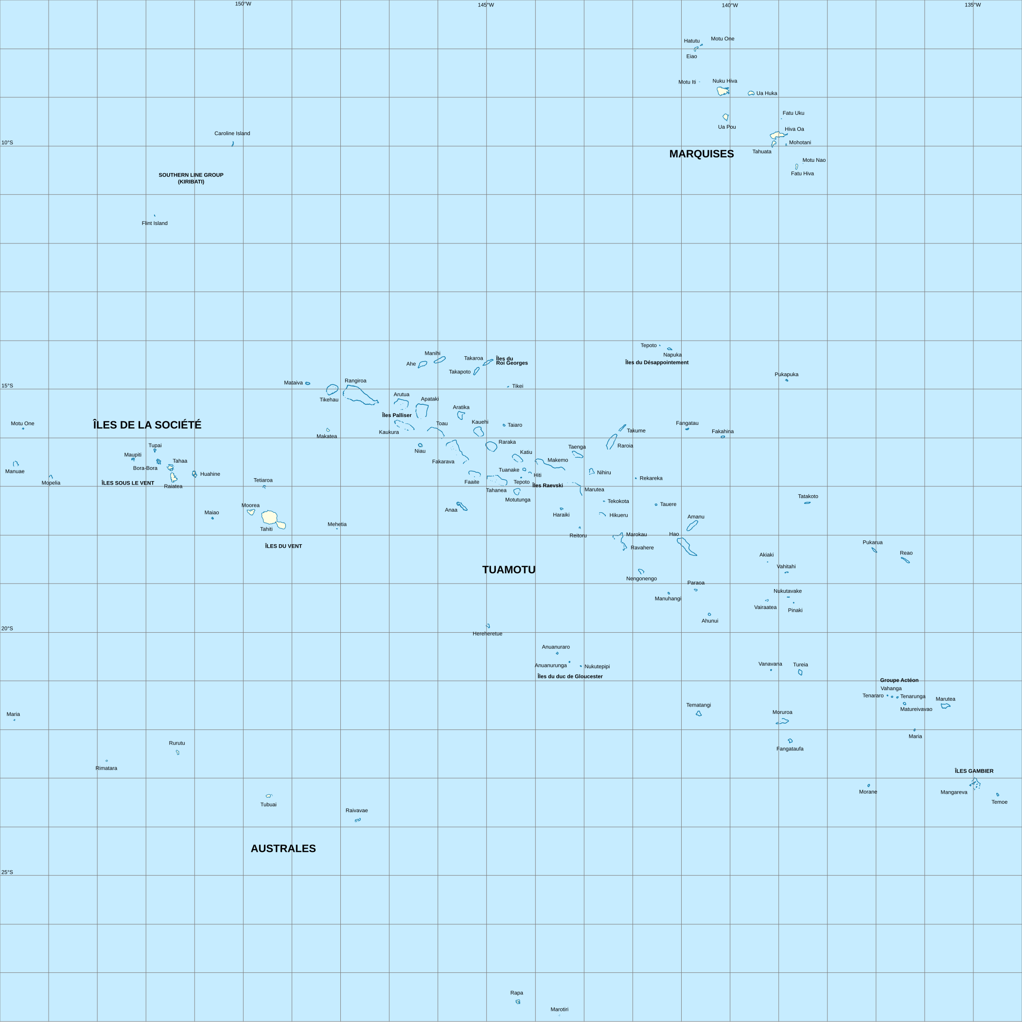
English: Map of French Polynesia
Français : Carte de la Polynésie française |
| Date | |
| Source |
Travail personnel (own work).
Data sources:
Softwares used:
Others:
|
| Author | Sardon |
Licensing edit
| I, the copyright holder of this work, release this work into the public domain. This applies worldwide. In some countries this may not be legally possible; if so: I grant anyone the right to use this work for any purpose, without any conditions, unless such conditions are required by law. |
File history
Click on a date/time to view the file as it appeared at that time.
| Date/Time | Thumbnail | Dimensions | User | Comment | |
|---|---|---|---|---|---|
| current | 11:01, 29 September 2008 | | 2,102 × 2,102 (453 KB) | Sardon (talk | contribs) | {{Information |Description={{en|1=Map of French Polynesia}} {{fr|1=Carte de la Polynésie française}} |Source=Travail personnel (own work). {{clr}} Data sources: * Background map : data from [http://www2.jpl.nasa.gov/srtm NASA Shuttle Radar Topography Mi |
You cannot overwrite this file.
File usage on Commons
There are no pages that use this file.
File usage on other wikis
The following other wikis use this file:
- Usage on es.wikipedia.org
- Usage on eu.wikipedia.org
- Usage on fr.wikipedia.org