File:Map of Ibaraki Prefecture Ja.svg

Original file (SVG file, nominally 450 × 567 pixels, file size: 16 KB)
Captions
Captions
Summary edit
| Description |
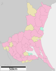
English: Map of Ibaraki Prefecture, Japan.
日本語: ja:茨城県区画図 |
||
| Date | (UTC) | ||
| Source |
|
||
| Author | Lincun | ||
| Permission (Reusing this file) |
|
Licensing edit

|
Permission is granted to copy, distribute and/or modify this document under the terms of the GNU Free Documentation License, Version 1.2 or any later version published by the Free Software Foundation; with no Invariant Sections, no Front-Cover Texts, and no Back-Cover Texts. A copy of the license is included in the section entitled GNU Free Documentation License. |
- You are free:
- to share – to copy, distribute and transmit the work
- to remix – to adapt the work
- Under the following conditions:
- attribution – You must give appropriate credit, provide a link to the license, and indicate if changes were made. You may do so in any reasonable manner, but not in any way that suggests the licensor endorses you or your use.
- share alike – If you remix, transform, or build upon the material, you must distribute your contributions under the same or compatible license as the original.
Original upload log edit
| This file was moved from Japanese Wikipedia.
See below for original file information. | ||||||||||||||||||||||||||||||||||||||||||||
| ||||||||||||||||||||||||||||||||||||||||||||
|
| ||||||||||||||||||||||||||||||||||||||||||||
File history
Click on a date/time to view the file as it appeared at that time.
| Date/Time | Thumbnail | Dimensions | User | Comment | |
|---|---|---|---|---|---|
| current | 04:23, 4 December 2020 | | 450 × 567 (16 KB) | AichiWikiFixer (talk | contribs) | Update borders and fixes. |
| 04:37, 23 August 2019 |  | 560 × 700 (26 KB) | LT sfm (talk | contribs) | Fixed the color of sea and villages | |
| 04:36, 23 August 2019 |  | 560 × 700 (26 KB) | LT sfm (talk | contribs) | 海と東海村・美浦村の配色を修正 | |
| 00:35, 8 August 2012 |  | 560 × 700 (32 KB) | ニンジンシチュー (talk | contribs) | デザイン変更(スケールバーの位置、配色) | |
| 00:34, 8 August 2012 |  | 560 × 700 (32 KB) | ニンジンシチュー (talk | contribs) | デザイン変更(スケールバーの位置、配色) | |
| 21:07, 28 April 2008 |  | 560 × 772 (18 KB) | Krisgrotius (talk | contribs) | {{Information| |Description= Map of Ibaraki Prefecture, Japan. |Source= Japanese wiki [http://ja.wikipedia.org/wiki/%E7%94%BB%E5%83%8F:%E5%8C%85%E6%8B%AC%E8%87%AA%E6%B2%BB%E4%BD%93%E5%8C%BA%E7%94%BB%E5%9B%B3_08000.svg] |Date=~~~~~ |Author=[[:ja: 利用 | |
| 13:29, 24 September 2007 |  | 560 × 772 (18 KB) | Lincun (talk | contribs) | {{基礎自治体位置図画像情報|茨城県|}} |
You cannot overwrite this file.
File usage on Commons
The following 4 pages use this file:
File usage on other wikis
The following other wikis use this file:
- Usage on en.wikipedia.org
- Usage on gl.wikipedia.org
- Usage on id.wikipedia.org
- Usage on ja.wikipedia.org
- 茨城県立取手第二高等学校
- 偕楽園
- 茨城県立カシマサッカースタジアム
- 茨城キリスト教大学
- 茨城大学
- ひたちなか市総合運動公園陸上競技場
- 茨城県立医療大学
- 土浦城
- 水戸市立競技場
- 鹿島神宮
- 牛久大仏
- 茨城県立水戸第一高等学校・附属中学校
- 穴薬師古墳 (五霞町)
- 栃木県道・茨城県道1号宇都宮笠間線
- 土浦日本大学高等学校
- 茨城県立水戸南高等学校
- 大杉神社
- 茨城県立水海道第一高等学校・附属中学校
- 大洗磯前神社
- 酒列磯前神社
- 常磐神社
- 茨城県護国神社
- 吉田神社 (水戸市)
- 花園花貫県立自然公園
- 日立シビックセンター
- 南高野貝塚
- 国営ひたち海浜公園
- 太田城 (常陸国)
- 若宮八幡宮 (常陸太田市)
- 瑞龍山
- 流通経済大学
- 筑波山神社
- 土浦日本大学中等教育学校
- 水戸城
- 静神社
- 虎塚古墳
- 栗橋城
- 茨城県立下妻第一高等学校・附属中学校
- つくばセンタービル
- 茨城県立緑岡高等学校
- 茨城県立勝田高等学校
- 茨城県立岩井高等学校
- つくば国際大学高等学校
- 茨城県立水戸桜ノ牧高等学校
- 茨城県立土浦第三高等学校
- 茨城県立土浦工業高等学校
- 茨城県立土浦湖北高等学校
View more global usage of this file.