File:Map of Kafiristan LOC 2006627702.jpg
Size of this preview: 800 × 588 pixels. Other resolutions: 320 × 235 pixels | 640 × 470 pixels | 1,024 × 753 pixels | 1,280 × 941 pixels | 2,560 × 1,882 pixels | 3,764 × 2,767 pixels.
Original file (3,764 × 2,767 pixels, file size: 2.01 MB, MIME type: image/jpeg)
Captions
Captions
Add a one-line explanation of what this file represents
Summary edit
| Description |
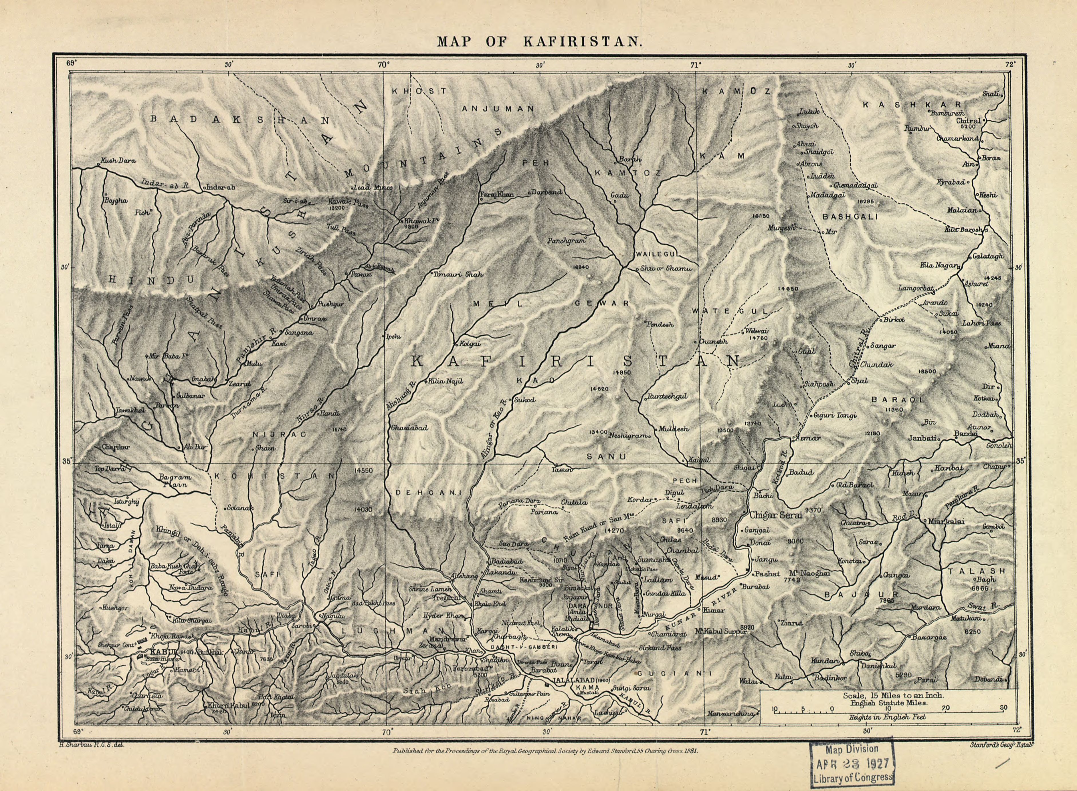
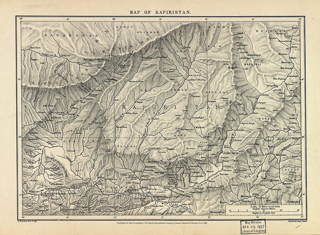
English: Relief shown in hachures and spot heights. "Published for the Proceedings of the Royal Geographical Society..." Available also through the Library of Congress Web site as a raster image. |
||
| Title | Map of Kafiristan | ||
| Shelf ID | G7633.N8 1881 .S5 | ||
| Date | |||
| Source | https://www.loc.gov/item/2006627702/ | ||
| Author | Sharbau, H. (Henry); Royal Geographical Society (Great Britain); Sharbau, H. | ||
| Permission (Reusing this file) |
|
||
| Other versions |
|
||
| Location | Nuristan · Afghanistan | ||
| Part of | American Memory · General Maps · Catalog · Geography And Map Division | ||
| Subject | Afghanistan · Nuristan (Afghanistan) · Nuristan · Maps |


Licensing edit
|
This is a faithful photographic reproduction of a two-dimensional, public domain work of art. The work of art itself is in the public domain for the following reason:
The official position taken by the Wikimedia Foundation is that "faithful reproductions of two-dimensional public domain works of art are public domain".
This photographic reproduction is therefore also considered to be in the public domain in the United States. In other jurisdictions, re-use of this content may be restricted; see Reuse of PD-Art photographs for details. | ||||
File history
Click on a date/time to view the file as it appeared at that time.
| Date/Time | Thumbnail | Dimensions | User | Comment | |
|---|---|---|---|---|---|
| current | 04:36, 9 June 2018 | | 3,764 × 2,767 (2.01 MB) | Fæ (talk | contribs) | LOC Maps https://www.loc.gov/item/2006627702/ #24464 |
You cannot overwrite this file.
File usage on Commons
The following page uses this file:
File usage on other wikis
The following other wikis use this file:
- Usage on fr.wikipedia.org