File:Map of Lebanon-ar.png
No higher resolution available.
Map_of_Lebanon-ar.png (325 × 349 pixels, file size: 42 KB, MIME type: image/png)
Captions
Captions
Add a one-line explanation of what this file represents
Summary
edit
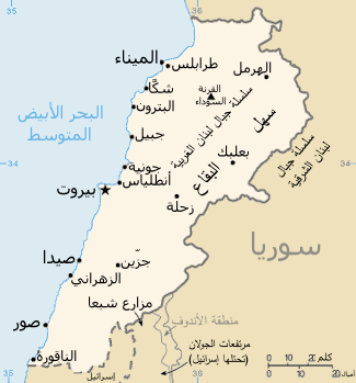
| Description |
العربية: خريطة لُبنان باللُغة العربيَّة. |
| Date | |
| Source | Derivative file from: this map, translated to Arabic |
| Author |
|
Licensing
edit
This image is in the public domain because it contains materials that originally came from the United States Central Intelligence Agency's World Factbook.
|
 |
File history
Click on a date/time to view the file as it appeared at that time.
| Date/Time | Thumbnail | Dimensions | User | Comment | |
|---|---|---|---|---|---|
| current | 12:41, 10 November 2013 | | 325 × 349 (42 KB) | باسم (talk | contribs) | User created page with UploadWizard |
You cannot overwrite this file.
File usage on Commons
There are no pages that use this file.
File usage on other wikis
The following other wikis use this file: