File:Map of Miribel region (XVIe century).jpg
No higher resolution available.
Map_of_Miribel_region_(XVIe_century).jpg (510 × 377 pixels, file size: 131 KB, MIME type: image/jpeg)
Captions
Captions
Add a one-line explanation of what this file represents
Summary edit
.jpg&action=edit§ion=1)
| Description |
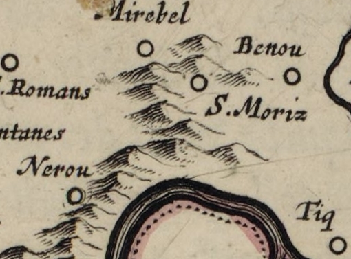
English: Map of miribel (Ain) region from a map of Bresse (XVIe century). |
| Date | (UTC) |
| Source |
This file was derived from: Plan Bresse 16xx.jpg: |
| Author |
|
| This is a retouched picture, which means that it has been digitally altered from its original version. Modifications: Extraction. The original can be viewed here: Plan Bresse 16xx.jpg:
|
Licensing edit
.jpg&action=edit§ion=2)
I, the copyright holder of this work, hereby publish it under the following license:
| Previous public domain rationale, no longer applicable | ||
|---|---|---|
|
Original upload log edit
.jpg&action=edit§ion=3)
This image is a derivative work of the following images:
- File:Plan_Bresse_16xx.jpg licensed with PD-GallicaScan
- 2012-03-17T11:20:50Z JeanBono 9305x7763 (30319018 Bytes) =={{int:filedesc}}== {{Artwork | artist = | title = Bressia, vulgo Bresse | description = {{fr|Bressia, vulgo Bresse.}} | date = 16xx | gallery = {{Institution:BNF}} | Author
Uploaded with derivativeFX
Licensing edit
.jpg&action=edit§ion=4)
I, the copyright holder of this work, hereby publish it under the following licenses:

|
Permission is granted to copy, distribute and/or modify this document under the terms of the GNU Free Documentation License, Version 1.2 or any later version published by the Free Software Foundation; with no Invariant Sections, no Front-Cover Texts, and no Back-Cover Texts. A copy of the license is included in the section entitled GNU Free Documentation License. |
This file is licensed under the Creative Commons Attribution-Share Alike 3.0 Unported license.
- You are free:
- to share – to copy, distribute and transmit the work
- to remix – to adapt the work
- Under the following conditions:
- attribution – You must give appropriate credit, provide a link to the license, and indicate if changes were made. You may do so in any reasonable manner, but not in any way that suggests the licensor endorses you or your use.
- share alike – If you remix, transform, or build upon the material, you must distribute your contributions under the same or compatible license as the original.
You may select the license of your choice.
File history
Click on a date/time to view the file as it appeared at that time.
| Date/Time | Thumbnail | Dimensions | User | Comment | |
|---|---|---|---|---|---|
| current | 16:02, 17 March 2012 | | 510 × 377 (131 KB) | Benoît Prieur (talk | contribs) | == {{int:filedesc}} == {{Information |Description={{en|Map of miribel (Ain) region from a map of Bresse (XVIe century).}} |Source={{Derived from|Plan_Bresse_16xx.jpg|display=50}} |Date=2012-03-17 16:00 (UTC) |Author=*File:Plan_Bresse_16xx.jpg: Ga... |
You cannot overwrite this file.
File usage on Commons
The following 2 pages use this file:
File usage on other wikis
The following other wikis use this file:
- Usage on fr.wikipedia.org
- Usage on fr.wikivoyage.org
.jpg&oldid=759594046)