File:Map of NRW showing Lippe.svg

Size of this PNG preview of this SVG file: 600 × 600 pixels. Other resolutions: 240 × 240 pixels | 480 × 480 pixels | 768 × 768 pixels | 1,024 × 1,024 pixels | 2,048 × 2,048 pixels | 660 × 660 pixels.
Original file (SVG file, nominally 660 × 660 pixels, file size: 235 KB)
Captions
Captions
Add a one-line explanation of what this file represents
Summary edit
| Description |
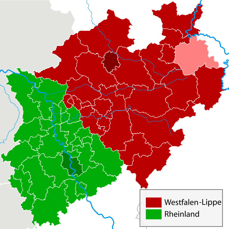
English: A map showing the two divisions of North Rhine-Westphalia (as on original) but with Lippe area coloured pink so as to help with the communication of the coat of arms of North Rhine-Westphalia which contains references to these three areas. Note that Lippe is part of Westphalia normally, highlighted here because of historical significance. |
| Date | |
| Source | File:North rhine w Landschaftsverbände.svg and some research |
| Author | English Wikipedia user Jarry1250, Wikimedia Commons user TUBS |
| Permission (Reusing this file) |
See below, as relevant to the original licensing of the source file |
Licensing edit

|
Permission is granted to copy, distribute and/or modify this document under the terms of the GNU Free Documentation License, Version 1.2 or any later version published by the Free Software Foundation; with no Invariant Sections, no Front-Cover Texts, and no Back-Cover Texts. A copy of the license is included in the section entitled GNU Free Documentation License. |
| This file is licensed under the Creative Commons Attribution-Share Alike 3.0 Unported license. | ||
| ||
| This licensing tag was added to this file as part of the GFDL licensing update. |
Original upload log edit
Transferred from en.wikipedia to Commons using For the Common Good.
The original description page was here. All following user names refer to en.wikipedia.
| Date/Time | Dimensions | User | Comment |
|---|---|---|---|
| 17:27, 15 April 2009 | 660 × 660 (241,092 bytes) | w:en:Jarry1250 (talk | contribs) | Fix text (no longer labelled) |
| 17:25, 15 April 2009 | 660 × 660 (241,587 bytes) | w:en:Jarry1250 (talk | contribs) | {{Information |Description = A map showing the two divisions of North Rhine-Westphalia (as on original) but with Lippe area labelled "1" so as to help with the communication of the coat of arms of North Rhine-Westphalia which contains references to th |
File history
Click on a date/time to view the file as it appeared at that time.
| Date/Time | Thumbnail | Dimensions | User | Comment | |
|---|---|---|---|---|---|
| current | 20:51, 29 September 2018 | | 660 × 660 (235 KB) | OgreBot (talk | contribs) | (BOT): Reverting to most recent version before archival |
| 20:51, 29 September 2018 |  | 660 × 660 (236 KB) | OgreBot (talk | contribs) | (BOT): Uploading old version of file from en.wikipedia; originally uploaded on 2009-04-15 17:25:09 by Jarry1250 | |
| 00:45, 28 September 2018 |  | 660 × 660 (235 KB) | Arlene the bean (talk | contribs) | Transferred from en.wikipedia: see original upload log above |
You cannot overwrite this file.
File usage on Commons
There are no pages that use this file.
File usage on other wikis
The following other wikis use this file:
- Usage on en.wikipedia.org