File:Map of Ohio, Monongalia, & Yohogania Counties.jpg
Size of this preview: 518 × 600 pixels. Other resolutions: 207 × 240 pixels | 415 × 480 pixels | 1,002 × 1,160 pixels.
Original file (1,002 × 1,160 pixels, file size: 199 KB, MIME type: image/jpeg)
Captions
Captions
Add a one-line explanation of what this file represents
Summary
edit
| Description |
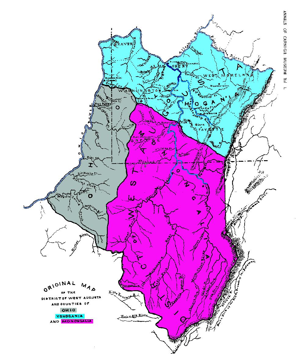
English: Map of Ohio, Monongalia, & Yohogania Counties. |
| Date | |
| Source | Taken from Volume I of the Annals of the Carnegie Museum, published in 1901 |
| Author |
Licensing
edit
This media file is in the public domain in the United States. This applies to U.S. works where the copyright has expired, often because its first publication occurred prior to January 1, 1929, and if not then due to lack of notice or renewal. See this page for further explanation.
|
 | |
 |
This image might not be in the public domain outside of the United States; this especially applies in the countries and areas that do not apply the rule of the shorter term for US works, such as Canada, Mainland China (not Hong Kong or Macao), Germany, Mexico, and Switzerland. The creator and year of publication are essential information and must be provided. See Wikipedia:Public domain and Wikipedia:Copyrights for more details.
|
Original upload log
edit
The original description page was here. All following user names refer to en.wikipedia.
- 2006-07-25 18:20 Argyriou 1002×1160× (203802 bytes) Map of Ohio, Monongalia, & Yohogania Counties.
File history
Click on a date/time to view the file as it appeared at that time.
| Date/Time | Thumbnail | Dimensions | User | Comment | |
|---|---|---|---|---|---|
| current | 13:32, 3 June 2014 | | 1,002 × 1,160 (199 KB) | Deadstar (talk | contribs) | Transferred from en.wikipedia |
You cannot overwrite this file.
File usage on Commons
There are no pages that use this file.
File usage on other wikis
The following other wikis use this file:
- Usage on en.wikipedia.org