File:Map of Ontario NORTHERN.svg

Size of this PNG preview of this SVG file: 340 × 330 pixels. Other resolutions: 247 × 240 pixels | 495 × 480 pixels | 791 × 768 pixels | 1,055 × 1,024 pixels | 2,110 × 2,048 pixels.
Original file (SVG file, nominally 340 × 330 pixels, file size: 83 KB)
Captions
Captions
Add a one-line explanation of what this file represents
Summary edit
This W3C-unspecified vector image was created with Inkscape .
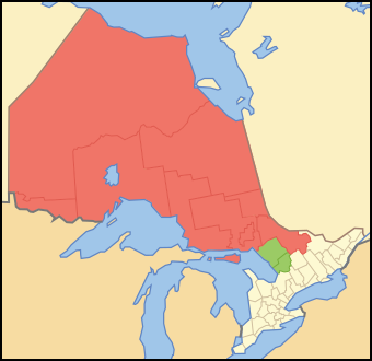
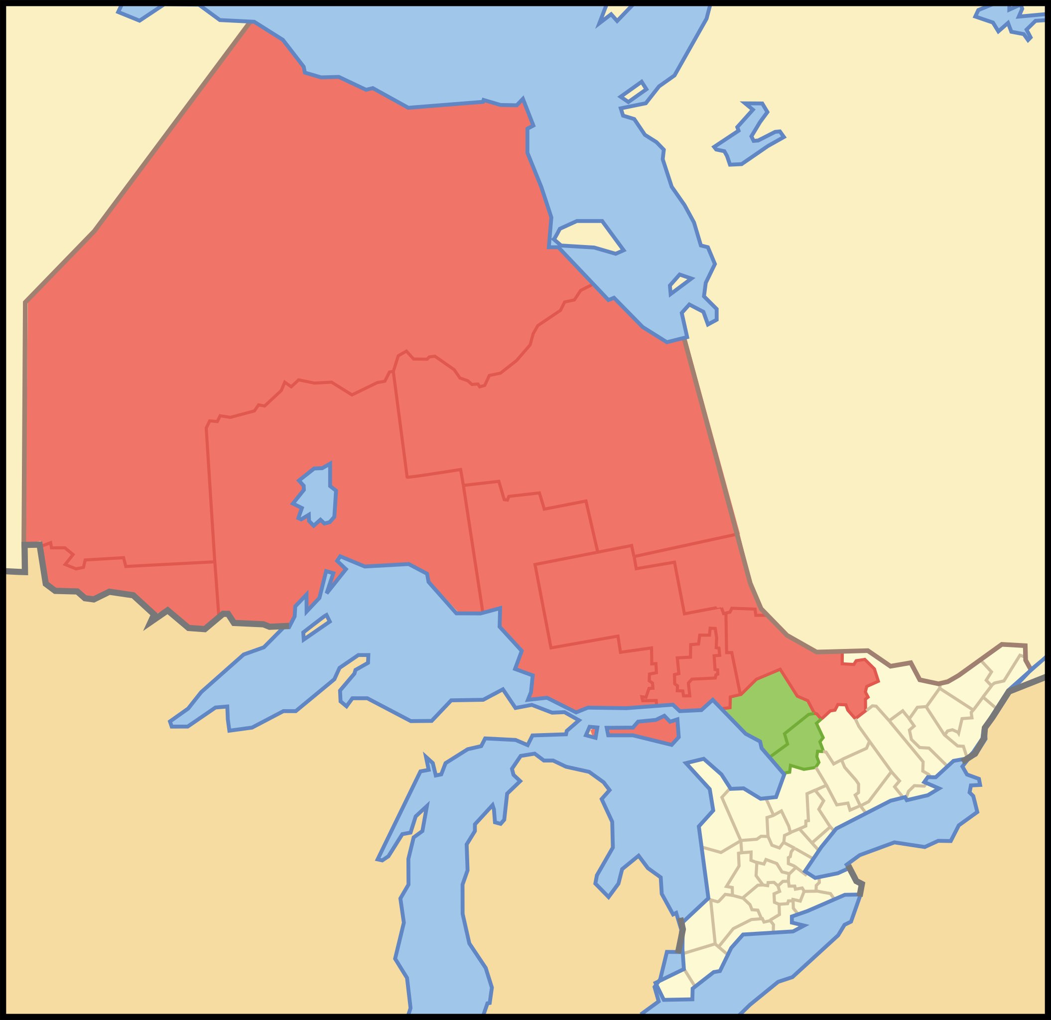
| Description | Map showing en:Northern Ontario. Red is the districts always considered Northern Ontario. Green are the districts sometimes considered Northern Ontario. |
| Date | |
| Source | Crop and trace of Image:Canada (geolocalisation).svg; trace of Image:Ontario subdivisions.PNG. |
| Author | Vidioman |
| Other versions | Image:Noront.PNG, Image:Northern Ontario Map Green.png |
.svg)
Licensing edit
| I, the copyright holder of this work, release this work into the public domain. This applies worldwide. In some countries this may not be legally possible; if so: I grant anyone the right to use this work for any purpose, without any conditions, unless such conditions are required by law. |
File history
Click on a date/time to view the file as it appeared at that time.
| Date/Time | Thumbnail | Dimensions | User | Comment | |
|---|---|---|---|---|---|
| current | 12:03, 12 October 2007 | | 340 × 330 (83 KB) | Vidioman (talk | contribs) | {{Created with Inkscape}} {{Information |Description=Map showing Northern Ontario. Red is the districts always considered Northern Ontario. Green are the districts sometimes considered Northern Ontario. |Source=Crop and trace of [[:Image:Canada (geolocali |
You cannot overwrite this file.
File usage on Commons
The following 2 pages use this file:
File usage on other wikis
The following other wikis use this file:
- Usage on en.wikipedia.org
- Northern Ontario
- Abitibi Canyon
- Acanthus, Ontario
- Achray, Ontario
- Adanac, Nipissing District, Ontario
- Unorganized South Nipissing District
- Whitefish Lake 6, Ontario
- Centennial Park (Thunder Bay)
- Lake Manitou
- Sturgeon Falls
- Kiosk, Ontario
- Estaire, Ontario
- Kukatush, Ontario
- Prince, Ontario
- Cedar Lake (Nipissing District)
- Red Cedar Lake (Ontario)
- Wabigoon Lake
- Spence, Ontario
- Unorganized Kenora District
- Papineau-Cameron
- Calvin, Ontario
- Bridal Veil Falls (Manitoulin Island)
- Unorganized North Nipissing District
- Thunder Bay (Ontario)
- Balsam Creek, Ontario
- Bear Island (Lake Temagami)
- Evanturel
- Tidewater Provincial Park
- Template:NorthernOntario-geo-stub
- Sudbury Downs
- Marten River, Ontario
- Chisholm, Ontario
- La Verendrye Provincial Park
- Opeongo River Provincial Park
- Sultan, Ontario
- Aroland First Nation
- Osnaburgh 63A
- Lount Township, Ontario
- Hollinger Park
- Ryerson, Ontario
- Joly, Ontario
- Burpee and Mills
- False Detour Channel
- Mississagi Strait
- Goat Island (Ontario)
- Maynard Lake
- Lac Seul
- Whitewater Lake
- Paradis Bay, Ontario
- Ojibway Provincial Park
View more global usage of this file.