File:Map of Rose Point in Slippery Rock Township, 1872.png

Map_of_Rose_Point_in_Slippery_Rock_Township,_1872.png (414 × 277 pixels, file size: 88 KB, MIME type: image/png)
Captions
Captions
| Description |
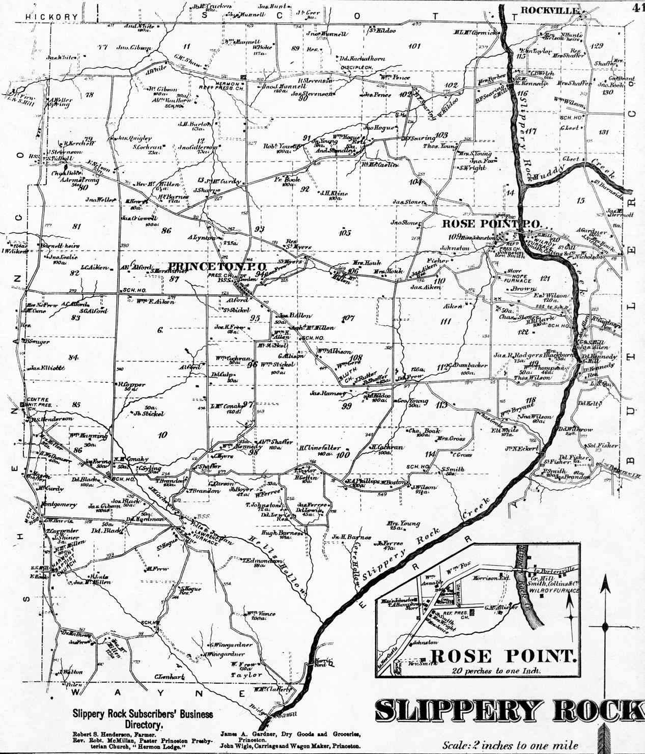
English: Map of Rose Point, an unincorporated community in Slippery Rock Township, Lawrence County, Pennsylvania, United States. Image taken from Atlas of the County of Lawrence and the State of Pennsylvania, published in 1872 by G.M. Hopkins & Co. of Philadelphia. |
||||
| Date | |||||
| Source | Posted at this page on the USGenWeb maps project for Lawrence County. | ||||
| Author | Unknown author | ||||
| Permission (Reusing this file) |
|
||||
| Other versions | Cropped from File:Map of Slippery Rock Township, 1872.png | ||||
File history
Click on a date/time to view the file as it appeared at that time.
| Date/Time | Thumbnail | Dimensions | User | Comment | |
|---|---|---|---|---|---|
| current | 05:04, 13 December 2008 | | 414 × 277 (88 KB) | Nyttend (talk | contribs) | {{Information |Description=Map of {{w|Rose Point, Pennsylvania|Rose Point}}, an {{w|unincorporated area|unincorporated community}} in {{w|Slippery Rock Township, Lawrence County, Pennsylvania|Slippery Rock Township}}, {{w|Lawrence County, Pennsylvania|Law |
You cannot overwrite this file.
File usage on Commons
There are no pages that use this file.
File usage on other wikis
The following other wikis use this file:
- Usage on en.wikipedia.org