File:Map of Russia - Jewish Autonomous Oblast (Crimea disputed).svg

Size of this PNG preview of this SVG file: 800 × 440 pixels. Other resolutions: 320 × 176 pixels | 640 × 352 pixels | 1,024 × 563 pixels | 1,280 × 704 pixels | 2,560 × 1,407 pixels | 1,541 × 847 pixels.
Original file (SVG file, nominally 1,541 × 847 pixels, file size: 574 KB)
Captions
Captions
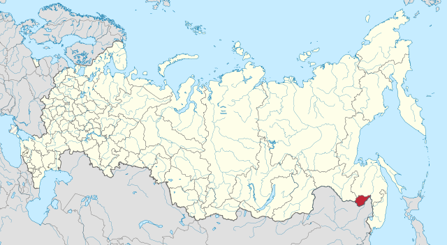
Map of the Jewish Autonomous Oblast within Russia.
Summary edit
.svg&action=edit§ion=1)
| Description |
Русский: Еврейская автономная область на карте России (с выделением Крыма в качестве спорного) |
| Date | |
| Source |
This file was derived from: |
| Author |
|
.svg)
| This is a retouched picture, which means that it has been digitally altered from its original version. Modifications: Hatched Crimea. The original can be viewed here: Map of Russia - Chechnya (Crimea disputed).svg:
|
Licensing edit
.svg&action=edit§ion=2)
This file is licensed under the Creative Commons Attribution-Share Alike 3.0 Unported license.
- You are free:
- to share – to copy, distribute and transmit the work
- to remix – to adapt the work
- Under the following conditions:
- attribution – You must give appropriate credit, provide a link to the license, and indicate if changes were made. You may do so in any reasonable manner, but not in any way that suggests the licensor endorses you or your use.
- share alike – If you remix, transform, or build upon the material, you must distribute your contributions under the same or compatible license as the original.
Original upload log edit
.svg&action=edit§ion=3)
This image is a derivative work of the following images:
- File:Map of Russia - Jewish Autonomous Oblast.svg licensed with Cc-by-sa-4.0
- 2015-04-22T00:47:26Z Stasyan117 1541x847 (6883834 Bytes) User created page with UploadWizard
- File:Map of Russia - Chechnya (Crimea disputed).svg licensed with Cc-by-sa-4.0
Uploaded with derivativeFX
File history
Click on a date/time to view the file as it appeared at that time.
| Date/Time | Thumbnail | Dimensions | User | Comment | |
|---|---|---|---|---|---|
| current | 20:21, 14 January 2023 | | 1,541 × 847 (574 KB) | Mellk (talk | contribs) | Reverted to version as of 11:04, 26 May 2020 (UTC) |
| 07:55, 4 October 2022 |  | 1,541 × 847 (6.59 MB) | President Loki (talk | contribs) | fixed mistake | |
| 23:26, 3 October 2022 |  | 1,541 × 847 (6.58 MB) | President Loki (talk | contribs) | Added disputed Luhansk, Donetsk, Kherson and Zaporizhzhia | |
| 11:04, 26 May 2020 |  | 1,541 × 847 (574 KB) | Seryo93 (talk | contribs) | Removed embedded raster layer, to make file more lightweight | |
| 10:52, 26 May 2020 |  | 1,541 × 847 (6.57 MB) | Seryo93 (talk | contribs) | == {{int:filedesc}} == {{Information |Description={{ru|1=Еврейская автономная область на карте России (с выделением Крыма в качестве спорного)}} |date=2020-05-26 |Source={{Derived from|Map of Russia - Jewish Autonomous Oblast.svg|Map of Russia - Chechnya (Crimea disputed).svg|display=50}} |Date=2020-05-26 10:49 (UTC) |Author=* File:Map of Russia - Jewish Autonomous Oblast.svg: Stasyan117 * [[:File:Map of Russia - Chech... |
You cannot overwrite this file.
File usage on Commons
The following 10 pages use this file:
- Category:Economy of Jewish Autonomous Oblast
- Category:Education in Jewish Autonomous Oblast
- Category:Jewish Autonomous Oblast
- Category:Maps of Jewish Autonomous Oblast
- Category:People of Jewish Autonomous Oblast
- Category:Rivers of Jewish Autonomous Oblast
- Category:Settlements in Jewish Autonomous Oblast
- Category:Train stations in Jewish Autonomous Oblast
- Category:Transport in Jewish Autonomous Oblast
- Category:Visitor attractions in the Jewish Autonomous Oblast
File usage on other wikis
The following other wikis use this file:
- Usage on ar.wikipedia.org
- Usage on arz.wikipedia.org
- Usage on ast.wikipedia.org
- Usage on az.wikipedia.org
- Usage on be.wikipedia.org
- Usage on bxr.wikipedia.org
- Usage on ca.wikipedia.org
- Usage on ce.wikipedia.org
- Usage on crh.wikipedia.org
- Usage on da.wikipedia.org
- Usage on el.wikipedia.org
- Usage on en.wikipedia.org
- Usage on es.wikipedia.org
- Usage on fa.wikipedia.org
- Usage on fy.wikipedia.org
- Usage on ga.wikipedia.org
- Usage on gl.wikipedia.org
- Usage on hy.wikipedia.org
- Usage on kv.wikipedia.org
- Usage on la.wikipedia.org
- Usage on lld.wikipedia.org
- Usage on lv.wikipedia.org
- Usage on ml.wikipedia.org
- Usage on mn.wikipedia.org
- Usage on myv.wikipedia.org
- Usage on mzn.wikipedia.org
- Usage on nds.wikipedia.org
- Usage on os.wikipedia.org
- Usage on ru.wikipedia.org
- Usage on sl.wikipedia.org
- Usage on sr.wikipedia.org
- Usage on tg.wikipedia.org
- Usage on th.wikipedia.org
View more global usage of this file.
.svg)
.svg&oldid=725145402)