File:Map of Russia - North Caucasian Federal District.svg

Size of this PNG preview of this SVG file: 800 × 462 pixels. Other resolutions: 320 × 185 pixels | 640 × 369 pixels | 1,024 × 591 pixels | 1,280 × 738 pixels | 2,560 × 1,477 pixels | 1,092 × 630 pixels.
Original file (SVG file, nominally 1,092 × 630 pixels, file size: 95 KB)
Captions
Captions
Add a one-line explanation of what this file represents

|
The boundaries on this map show the de facto situation. This is just one of several different views on the subject (see COM:NPOV). |
| Description |
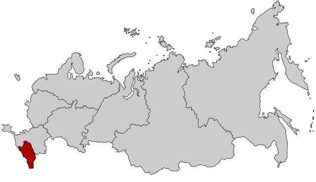
English: Map Russia highlighting the North Caucasian Federal districts.
Русский: Северо-Кавказский федеральный округ |
| Date | (UTC) |
| Source | Based on Map_of_Russian_subjects,_2008-03-01.svg |
| Author |
original: fremantleboy |
I, the copyright holder of this work, hereby publish it under the following license:
This file is licensed under the Creative Commons Attribution 2.5 Generic license.
- You are free:
- to share – to copy, distribute and transmit the work
- to remix – to adapt the work
- Under the following conditions:
- attribution – You must give appropriate credit, provide a link to the license, and indicate if changes were made. You may do so in any reasonable manner, but not in any way that suggests the licensor endorses you or your use.
Original upload log edit
This image is a derivative work of the following images:
- File:Map_of_Russian_subjects,_2008-03-01.svg licensed with Cc-by-2.5
- 2008-03-03T22:55:39Z Lokal Profil 1092x630 (296622 Bytes) Argh, updated using the wrong map. This is the 2008-03-01 map with federal district borders
- 2008-03-03T22:47:17Z Lokal Profil 1092x630 (295603 Bytes) Added thicker lines for Federal districts
- 2008-01-27T20:08:20Z Lokal Profil 1092x630 (227563 Bytes) Oupps... readded surrounding countries
- 2008-01-27T20:05:54Z Lokal Profil 1092x630 (191297 Bytes) Now also tagged by subject type
- 2008-01-26T23:00:44Z Lokal Profil 1092x630 (225978 Bytes) {{Information |Description=Map of Russia with merged subjects (01.03.2008, last merger [[w:en:Chita Oblast|Chita Oblast]]+[[w:en:Agin-Buryat Autonomous Okrug|Agin-Buryat Autonomous Okrug]] to form Zabaykalsky Krai.) The subje
Uploaded with derivativeFX
File history
Click on a date/time to view the file as it appeared at that time.
| Date/Time | Thumbnail | Dimensions | User | Comment | |
|---|---|---|---|---|---|
| current | 14:21, 10 March 2015 | | 1,092 × 630 (95 KB) | Knyaz-1988 (talk | contribs) | Reverted to version as of 22:11, 3 November 2014 |
| 01:28, 4 November 2014 |  | 1,092 × 630 (118 KB) | Fry1989 (talk | contribs) | NPOV issue. | |
| 22:11, 3 November 2014 |  | 1,092 × 630 (95 KB) | Knyaz-1988 (talk | contribs) | New version | |
| 22:04, 21 January 2010 |  | 1,092 × 630 (118 KB) | Denhud (talk | contribs) | {{Information |Description={{en|Map Russia highlighting the North Caucasian Federal districts.}} {{Ru|Северо-Кавказский федеральный округ}} |Source=Based on [[:File:Map_of_Russian_subject |
You cannot overwrite this file.
File usage on Commons
The following page uses this file:
.svg)
File usage on other wikis
The following other wikis use this file:
- Usage on ar.wikipedia.org
- Usage on arz.wikipedia.org
- Usage on azb.wikipedia.org
- Usage on be-tarask.wikipedia.org
- Usage on be.wikipedia.org
- Usage on bg.wikipedia.org
- Usage on ca.wikipedia.org
- Usage on el.wikipedia.org
- Usage on en.wikipedia.org
- Usage on es.wikipedia.org
- Usage on et.wikipedia.org
- Usage on eu.wikipedia.org
- Usage on fa.wikipedia.org
- Usage on hu.wikipedia.org
- Usage on ja.wikipedia.org
- Usage on kk.wikipedia.org
- Usage on ko.wikipedia.org
- Usage on mk.wikipedia.org
- Usage on mr.wikipedia.org
- Usage on nl.wikipedia.org
- Usage on pfl.wikipedia.org
- Usage on pl.wikipedia.org
- Usage on pl.wikivoyage.org
- Usage on pt.wikipedia.org
- Usage on ru.wikinews.org
- Usage on sv.wikipedia.org
- Usage on th.wikipedia.org
- Usage on tl.wikipedia.org
- Usage on tr.wikipedia.org
- Usage on uk.wikipedia.org
- Usage on vi.wikipedia.org
- Usage on www.wikidata.org
- Usage on zh-yue.wikipedia.org
- Usage on zh.wikipedia.org