File:Map of Suriname with Place Names.png

Size of this preview: 800 × 566 pixels. Other resolutions: 320 × 226 pixels | 640 × 453 pixels | 1,024 × 724 pixels | 1,280 × 905 pixels | 2,560 × 1,810 pixels | 3,507 × 2,480 pixels.
Original file (3,507 × 2,480 pixels, file size: 574 KB, MIME type: image/png)
Captions
Captions
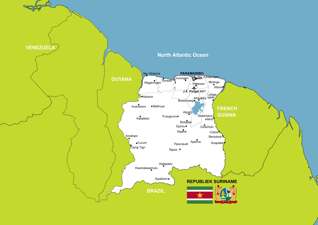
The Map of the Republic of Suriname with place names shown on the map.
Summary edit
| Description |
English: The Map of the Republic of Suriname with place names shown on the map. |
| Date | |
| Source | Own work |
| Author | SurinameCentral |
Licensing edit
I, the copyright holder of this work, hereby publish it under the following license:
This file is licensed under the Creative Commons Attribution-Share Alike 4.0 International license.
- You are free:
- to share – to copy, distribute and transmit the work
- to remix – to adapt the work
- Under the following conditions:
- attribution – You must give appropriate credit, provide a link to the license, and indicate if changes were made. You may do so in any reasonable manner, but not in any way that suggests the licensor endorses you or your use.
- share alike – If you remix, transform, or build upon the material, you must distribute your contributions under the same or compatible license as the original.
File history
Click on a date/time to view the file as it appeared at that time.
| Date/Time | Thumbnail | Dimensions | User | Comment | |
|---|---|---|---|---|---|
| current | 21:53, 30 December 2023 | | 3,507 × 2,480 (574 KB) | SurinameCentral (talk | contribs) | Partially visible islands on the right side of the map was left white. colored to match land color |
| 20:25, 8 November 2022 |  | 3,507 × 2,480 (548 KB) | SurinameCentral (talk | contribs) | Uploaded own work with UploadWizard |
You cannot overwrite this file.
File usage on Commons
The following page uses this file: