File:Map of Toronto, its railways, and the harbour.jpg
Size of this preview: 800 × 394 pixels. Other resolutions: 320 × 158 pixels | 640 × 315 pixels | 1,024 × 504 pixels | 1,920 × 945 pixels.
Original file (1,920 × 945 pixels, file size: 674 KB, MIME type: image/jpeg)
Captions
Captions
Add a one-line explanation of what this file represents
Summary edit
| Description |
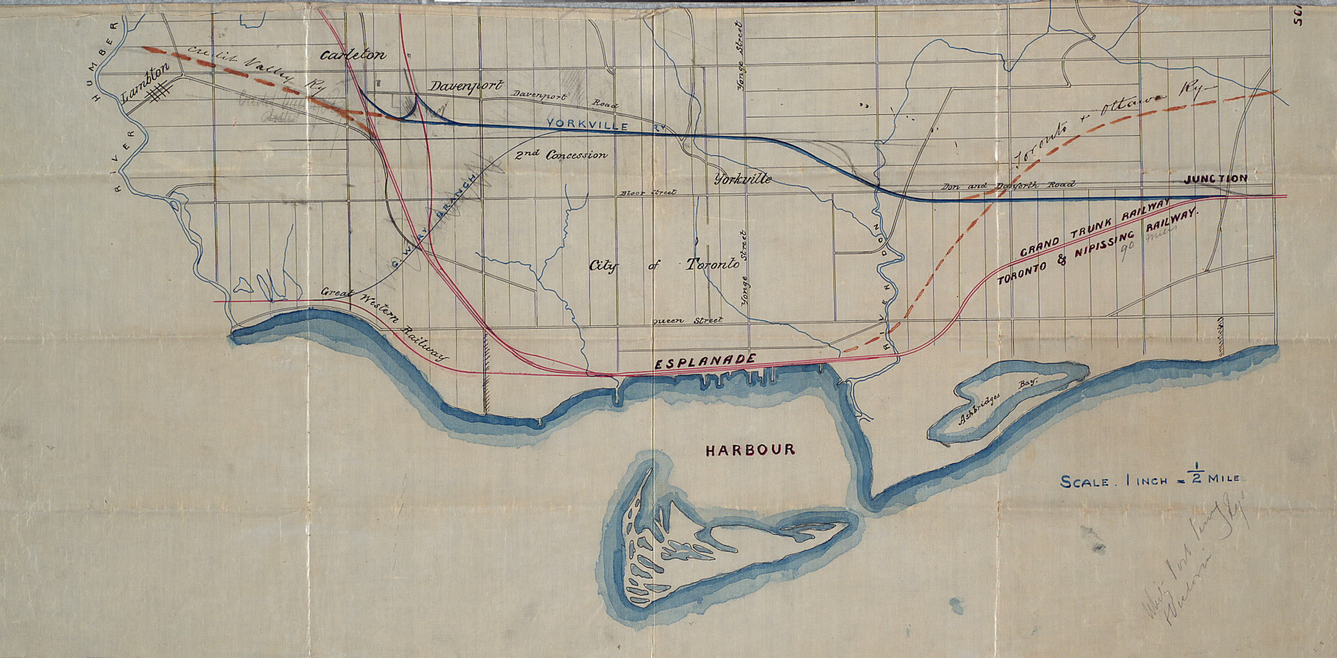
English: Map of the city of Toronto depicting the railways and its harbour. The Humber River and Don River are also indicated.
|
|||
| Date | Unknown date; late 1800s. | |||
| Source | Toronto at the Toronto Public Library | |||
| Author | Unknown author | |||
| Other versions |


Licensing edit
|
This work is in the public domain in its country of origin and other countries and areas where the copyright term is the author's life plus 100 years or fewer. | |
| This file has been identified as being free of known restrictions under copyright law, including all related and neighboring rights. | |
File history
Click on a date/time to view the file as it appeared at that time.
| Date/Time | Thumbnail | Dimensions | User | Comment | |
|---|---|---|---|---|---|
| current | 23:02, 12 February 2012 | | 1,920 × 945 (674 KB) | Mindmatrix (talk | contribs) | {{Information |Description ={{en|1=Map of the city of Toronto depicting the railways and its harbour. The Humber River and Don River are also indicated.}} |Source =[http://www.torontopubliclibrary.ca/detail.jsp?Entt=RDMDC-MAPS-R-121&R=DC-MAPS-R |
You cannot overwrite this file.
File usage on Commons
The following 2 pages use this file: