File:Map of Xiangkhoang Province, Laos.jpg

Size of this preview: 782 × 600 pixels. Other resolutions: 313 × 240 pixels | 626 × 480 pixels | 1,001 × 768 pixels | 1,305 × 1,001 pixels.
Original file (1,305 × 1,001 pixels, file size: 828 KB, MIME type: image/jpeg)
Captions
Captions
Add a one-line explanation of what this file represents
Summary edit
| Description |
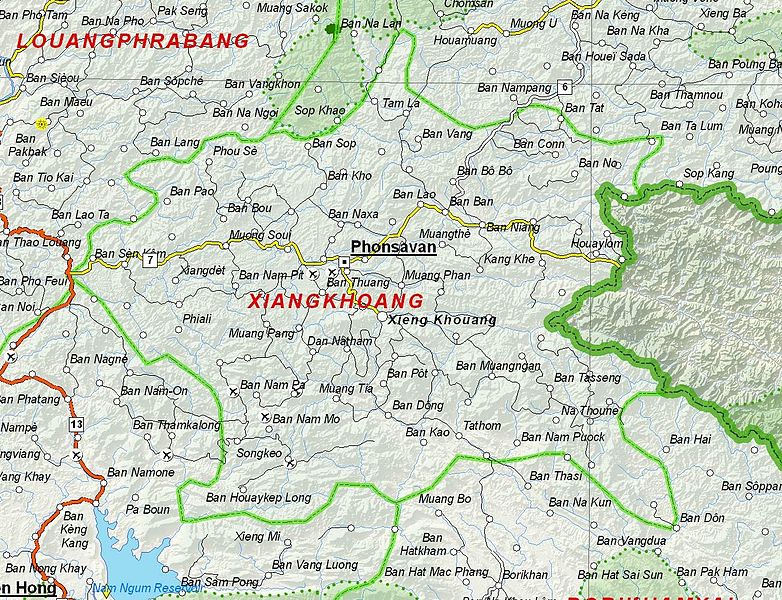
English: Map of Xiangkhoang Province, Laos. |
| Date | |
| Source | Based on File:UNOSAT Laos Base Map.jpg |
| Author | UNOSAT, United Nations, modified by Dr. Blofeld |
| Permission (Reusing this file) |
The original file is marked with the UN symbol which means that it is a public domain resource. |
Licensing edit
| This work is ineligible for copyright and therefore in the public domain because it consists entirely of information that is common property and contains no original authorship. |
File history
Click on a date/time to view the file as it appeared at that time.
| Date/Time | Thumbnail | Dimensions | User | Comment | |
|---|---|---|---|---|---|
| current | 21:10, 6 December 2012 | | 1,305 × 1,001 (828 KB) | Blofeld Dr. (talk | contribs) | {{Information |Description ={{en|1=d}} |Source =d |Author =d |Date =d |Permission = |other_versions = }} d |
You cannot overwrite this file.
File usage on Commons
There are no pages that use this file.
File usage on other wikis
The following other wikis use this file:
- Usage on br.wikipedia.org
- Usage on cs.wikipedia.org
- Usage on da.wikipedia.org
- Usage on de.wikipedia.org
- Usage on en.wikipedia.org
- Usage on es.wikipedia.org
- Usage on fa.wikipedia.org
- Usage on fr.wikipedia.org
- Usage on hr.wikipedia.org
- Usage on id.wikipedia.org
- Usage on th.wikipedia.org
- Usage on ur.wikipedia.org
- Usage on vi.wikipedia.org