File:Map of alaska volcanoes okmok.jpg
No higher resolution available.
Map_of_alaska_volcanoes_okmok.jpg (640 × 456 pixels, file size: 226 KB, MIME type: image/jpeg)
Captions
Captions
Add a one-line explanation of what this file represents

|
This geology image could be re-created using vector graphics as an SVG file. This has several advantages; see Commons:Media for cleanup for more information. If an SVG form of this image is available, please upload it and afterwards replace this template with
{{vector version available|new image name}}.
It is recommended to name the SVG file “Map of alaska volcanoes okmok.svg”—then the template Vector version available (or Vva) does not need the new image name parameter. |

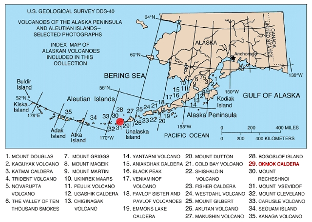
Map of Alaska volcanoes, Okmok Caldera, Alaska Volcanoes of the Alaska Peninsula and Aleutian Islands.
Source: http://geopubs.wr.usgs.gov/dds/dds-40/
This image is in the public domain in the United States because it only contains materials that originally came from the United States Geological Survey, an agency of the United States Department of the Interior. For more information, see the official USGS copyright policy.
|
File history
Click on a date/time to view the file as it appeared at that time.
| Date/Time | Thumbnail | Dimensions | User | Comment | |
|---|---|---|---|---|---|
| current | 08:15, 31 January 2005 | | 640 × 456 (226 KB) | GarciaB~commonswiki (talk | contribs) | Map of Alaska volcanoes, Okmok Cardera, Alaska |
You cannot overwrite this file.
File usage on Commons
There are no pages that use this file.
File usage on other wikis
The following other wikis use this file:
- Usage on ca.wikipedia.org
- Usage on en.wikipedia.org
- Usage on es.wikipedia.org
- Usage on gl.wikipedia.org
- Usage on it.wikipedia.org
- Usage on ja.wikipedia.org
- Usage on lt.wikipedia.org
- Usage on mk.wikipedia.org
- Usage on nn.wikipedia.org
- Usage on no.wikipedia.org
- Usage on pt.wikipedia.org
- Usage on ta.wikipedia.org
- Usage on zh.wikipedia.org