File:Map of the North-West Frontier Province and Kashmir from The Imperial Gazetteer of India (1907-1909).jpg
Size of this preview: 758 × 600 pixels. Other resolutions: 304 × 240 pixels | 607 × 480 pixels | 1,000 × 791 pixels.
Original file (1,000 × 791 pixels, file size: 275 KB, MIME type: image/jpeg)
Captions
Captions
Add a one-line explanation of what this file represents
Summary edit
.jpg&action=edit§ion=1)
| Description |
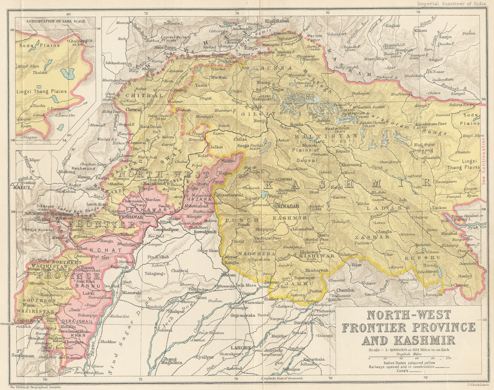
English: Map of the North-West Frontier Province and Kashmir from The Imperial Gazetteer of India Volume 19, opposite page 218. New edition, published under the authority of His Majesty's Secretary of State for India in Council. Oxford: Clarendon Press, 1907-1909.
Scale: 1:6,000,000. 1 in. to 94.6 miles. |
| Date | between 1907 and 1909 |
| Source | http://dsal.uchicago.edu/maps/gazetteer/index.html |
| Author | John G. Bartholomew |
Licensing edit
.jpg&action=edit§ion=2)
The author died in 1920, so this work is in the public domain in its country of origin and other countries and areas where the copyright term is the author's life plus 100 years or fewer. | |
| This file has been identified as being free of known restrictions under copyright law, including all related and neighboring rights. | |
File history
Click on a date/time to view the file as it appeared at that time.
| Date/Time | Thumbnail | Dimensions | User | Comment | |
|---|---|---|---|---|---|
| current | 06:19, 8 October 2014 | | 1,000 × 791 (275 KB) | Co9man (talk | contribs) | User created page with UploadWizard |
You cannot overwrite this file.
File usage on Commons
There are no pages that use this file.
File usage on other wikis
The following other wikis use this file:
- Usage on en.wikipedia.org
.jpg&oldid=418017768)