File:Map of the approaches and defences of Knoxville, Tenn., showing the positions occupied by the United States & Confederate forces during the siege. LOC 77693131.jpg

Size of this preview: 778 × 600 pixels. Other resolutions: 312 × 240 pixels | 623 × 480 pixels | 997 × 768 pixels | 1,280 × 987 pixels | 2,560 × 1,973 pixels | 9,755 × 7,519 pixels.
Original file (9,755 × 7,519 pixels, file size: 11.93 MB, MIME type: image/jpeg)
Captions
Captions
Add a one-line explanation of what this file represents
Summary edit
| Description |
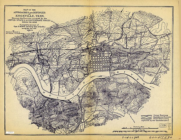
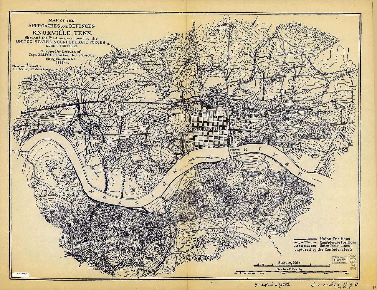
English: Scale ca. 1:9,600. Photocopy; blue line print. Relief shown by contours, hachures, and spot heights. LC Civil War maps (2nd ed.) 428.2 "G-X-I-455 K 90." Available also through the Library of Congress Web site as a raster image. AACR2 |
||
| Title | Map of the approaches and defences of Knoxville, Tenn., showing the positions occupied by the United States & Confederate forces during the siege. | ||
| Shelf ID | G3964.K7S5 1864 .R6 1974 | ||
| Date | |||
| Source | https://www.loc.gov/item/77693131/ | ||
| Author | Rockwell, Cleveland; Poe, O. M. (Orlando Metcalfe); Talcott, R. H.; Tennessee Valley Authority | ||
| Permission (Reusing this file) |
|
||
| Other versions |
|
||
| Location | Tennessee · United States · Knoxville | ||
| Part of | Military Battles And Campaigns · American Memory · Civil War Maps · Catalog · Geography And Map Division | ||
| Subject | Knoxville · Knoxville (Tenn.) · Civil War · United States · Maps · Tennessee · History |


Licensing edit
| This work is from the Library of Congress. According to the library, there are no known copyright restrictions on the use of this work. |  |
File history
Click on a date/time to view the file as it appeared at that time.
| Date/Time | Thumbnail | Dimensions | User | Comment | |
|---|---|---|---|---|---|
| current | 16:58, 14 May 2018 | | 9,755 × 7,519 (11.93 MB) | Fæ (talk | contribs) | LOC Maps https://www.loc.gov/item/77693131/ #14 |
You cannot overwrite this file.
File usage on Commons
The following page uses this file: