File:Map of the railways of Eyre Peninsula, South Australia, past and present.png

Size of this preview: 626 × 600 pixels. Other resolutions: 251 × 240 pixels | 501 × 480 pixels | 802 × 768 pixels | 1,069 × 1,024 pixels | 1,305 × 1,250 pixels.
Original file (1,305 × 1,250 pixels, file size: 345 KB, MIME type: image/png)
Captions
Captions
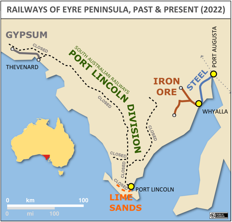
Map of the railways of Eyre Peninsula, South Australia, past and present (as at 2022)
Summary edit
| Description |
English: Schematic map of the railways of Eyre Peninsula, South Australia, past and present (updated to February 2022). Shows four bulk commodities conveyed by rail on specific lines. The lines of the Port Lincoln Division of the former South Australian Railways (SAR) are also shown: they carried passengers and general freight from 1908 to 1987, and after the demise of the SAR's successor agency carried bulk wheat traffic in trains operated by a private company; in 2019 they closed, with the exception of the gypsum line. |
| Date | |
| Source | Own work |
| Author | SCHolar44 |
Licensing edit
I, the copyright holder of this work, hereby publish it under the following license:
| This file is made available under the Creative Commons CC0 1.0 Universal Public Domain Dedication. | |
| The person who associated a work with this deed has dedicated the work to the public domain by waiving all of their rights to the work worldwide under copyright law, including all related and neighboring rights, to the extent allowed by law. You can copy, modify, distribute and perform the work, even for commercial purposes, all without asking permission.
|
File history
Click on a date/time to view the file as it appeared at that time.
| Date/Time | Thumbnail | Dimensions | User | Comment | |
|---|---|---|---|---|---|
| current | 08:07, 17 February 2022 | | 1,305 × 1,250 (345 KB) | SCHolar44 (talk | contribs) | Annotated closed lines, added South Australian Railways to Port Lincoln Division, yellow city markers |
| 08:17, 26 September 2020 |  | 1,947 × 1,864 (155 KB) | SCHolar44 (talk | contribs) | Uploaded own work with UploadWizard |
You cannot overwrite this file.
File usage on Commons
The following 3 pages use this file:
.png&redirect=no)