File:MapaHistóricoDeDobrudja.svg

Size of this PNG preview of this SVG file: 800 × 399 pixels. Other resolutions: 320 × 159 pixels | 640 × 319 pixels | 1,024 × 510 pixels | 1,280 × 638 pixels | 2,560 × 1,275 pixels | 1,628 × 811 pixels.
Original file (SVG file, nominally 1,628 × 811 pixels, file size: 92 KB)
Captions
Captions
Add a one-line explanation of what this file represents
| Description |
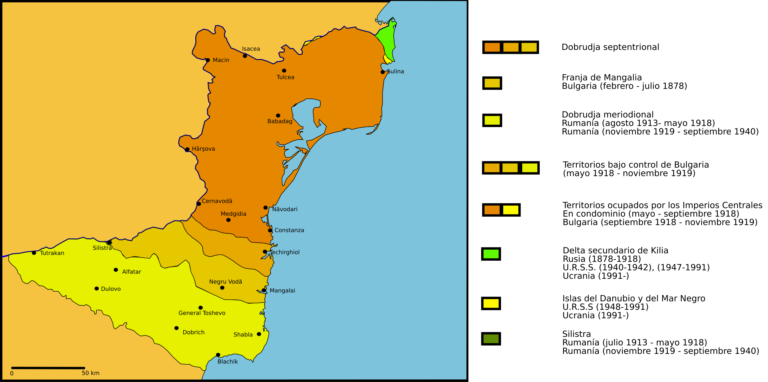
English: Borders in Dobruja since 1878
Español: Cambios de soberanía de la región histórica de la Dobrudja desde 1878. |
| Date | (UTC) |
| Source | |
| Author |
|
| Other versions | Derivative works of this file: MapaDeDobrudjaTratadoDeBucarest1918.svg |
| This is a retouched picture, which means that it has been digitally altered from its original version. Modifications: Spanish version and map turned into svg. The original can be viewed here: Histdob.png:
|
I, the copyright holder of this work, hereby publish it under the following license:
This file is licensed under the Creative Commons Attribution 2.5 Generic license.
- You are free:
- to share – to copy, distribute and transmit the work
- to remix – to adapt the work
- Under the following conditions:
- attribution – You must give appropriate credit, provide a link to the license, and indicate if changes were made. You may do so in any reasonable manner, but not in any way that suggests the licensor endorses you or your use.
Original upload log edit
This image is a derivative work of the following images:
- File:Histdob.png licensed with Cc-by-2.5
- 2006-12-20T22:30:29Z Electionworld 988x806 (51962 Bytes) {{ew|en|Anonimu}} == Summary == Dobruja from 1878 == Licensing == {{cc-by-2.5}} [[Category:Maps of the history of Bulgaria]] [[Category:Maps of the history of Romania]]
Uploaded with derivativeFX
File history
Click on a date/time to view the file as it appeared at that time.
| Date/Time | Thumbnail | Dimensions | User | Comment | |
|---|---|---|---|---|---|
| current | 10:18, 22 April 2010 | | 1,628 × 811 (92 KB) | Rowanwindwhistler (talk | contribs) | {{Information |Description={{en|1=Borders in Dobruja since 1878}} {{es|1=Cambios de soberanía de la región histórica de la Dobrudja desde 1878.}} |Source=*File:Histdob.png |Date=2010-04-22 10:17 (UTC) |Author=*[[:File:Histdob.png| |
You cannot overwrite this file.
File usage on Commons
The following page uses this file: