File:Mapa Čadu.png

Size of this preview: 274 × 598 pixels. Other resolutions: 110 × 240 pixels | 327 × 714 pixels.
Original file (327 × 714 pixels, file size: 17 KB, MIME type: image/png)
Captions
Captions
Add a one-line explanation of what this file represents
Summary edit
| Description |
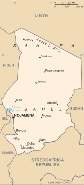
Čeština: Mapa Čadu s českými popisky.
English: Map of Chad with Czech description. |
| Source |
|
| Author |
Licensing edit
This image is in the public domain because it contains materials that originally came from the United States Central Intelligence Agency's World Factbook.
|
 |
Original upload log edit
The original description page was here. All following user names refer to cs.wikipedia.
- 2006-07-07 15:05 Nádvorník 327×714×4 (17135 bytes) Mapa [[Čad]]u - přeložená mapa z CIA World Factbook.
File history
Click on a date/time to view the file as it appeared at that time.
| Date/Time | Thumbnail | Dimensions | User | Comment | |
|---|---|---|---|---|---|
| current | 11:27, 25 June 2008 | | 327 × 714 (17 KB) | Sevela.p (talk | contribs) | {{Information |Description= {{cs|Mapa Čadu s českými popisky.}} {{en|Map of Chad with Czech description.}} |Source= *Translated from map CIA World Factbook *Transferred from [http://cs.wikipedia.org cs.wikipedia]; transfered to Commons by |
You cannot overwrite this file.
File usage on Commons
The following 2 pages use this file:
.png)
File usage on other wikis
The following other wikis use this file:
- Usage on cs.wikipedia.org