File:Mapa Canarias Tenerife.svg

Size of this PNG preview of this SVG file: 800 × 336 pixels. Other resolutions: 320 × 134 pixels | 640 × 269 pixels | 1,024 × 430 pixels | 1,280 × 537 pixels | 2,560 × 1,074 pixels | 977 × 410 pixels.
Original file (SVG file, nominally 977 × 410 pixels, file size: 27 KB)
Captions
Captions
Add a one-line explanation of what this file represents
Summary edit
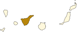
| Description | Map of Lanzarote, Canary Islands. |
| Date | |
| Source | Image:Mapa Canarias.svg |
| Author | Júlio Reis |
Licensing edit
This file is licensed under the Creative Commons Attribution-Share Alike 3.0 Unported license.
- You are free:
- to share – to copy, distribute and transmit the work
- to remix – to adapt the work
- Under the following conditions:
- attribution – You must give appropriate credit, provide a link to the license, and indicate if changes were made. You may do so in any reasonable manner, but not in any way that suggests the licensor endorses you or your use.
- share alike – If you remix, transform, or build upon the material, you must distribute your contributions under the same or compatible license as the original.
File history
Click on a date/time to view the file as it appeared at that time.
| Date/Time | Thumbnail | Dimensions | User | Comment | |
|---|---|---|---|---|---|
| current | 17:39, 19 July 2006 | | 977 × 410 (27 KB) | Tintazul (talk | contribs) | {{Tintazul |Description=Map of Lanzarote, Canary Islands. |Source=Image:Mapa Canarias.svg |Date=19 July 2006 }} Category:Maps of the Canary Islands |
You cannot overwrite this file.
File usage on Commons
The following 4 pages use this file:
File usage on other wikis
The following other wikis use this file:
- Usage on af.wikipedia.org
- Usage on an.wikipedia.org
- Usage on ca.wikipedia.org
- Usage on de.wiktionary.org
- Usage on eo.wikipedia.org
- Usage on fr.wikipedia.org
- El Rosario (Tenerife)
- Candelaria (Tenerife)
- Santa Cruz de Tenerife
- Icod de los Vinos
- Adeje
- Arona (Tenerife)
- Arafo
- Vilaflor de Chasna
- Tegueste
- Buenavista del Norte
- Fasnia
- Garachico
- Granadilla de Abona
- Puerto de la Cruz
- La Guancha
- Guía de Isora
- Güímar
- La Matanza de Acentejo
- El Tanque
- La Victoria de Acentejo
- San Cristóbal de La Laguna
- Los Realejos
- San Juan de la Rambla
- Santa Úrsula (Tenerife)
- Santiago del Teide
- El Sauzal (Tenerife)
- Los Silos
- Tacoronte
- San Miguel de Abona
- La Orotava
- Arico
- Circonscription électorale de Tenerife
- Usage on fy.wikipedia.org
- Usage on gl.wikipedia.org
- Usage on hu.wikipedia.org
- Usage on incubator.wikimedia.org
- Usage on la.wikipedia.org
- Usage on mn.wikipedia.org
- Usage on mr.wikipedia.org
- Usage on no.wikipedia.org
- Usage on oc.wikipedia.org
- Usage on pl.wikivoyage.org
- Usage on sc.wikipedia.org
- Usage on zgh.wikipedia.org
- Usage on zh.wikipedia.org