File:Mapa Ferrocarril Caldera Copiapó.svg

Size of this PNG preview of this SVG file: 742 × 599 pixels. Other resolutions: 297 × 240 pixels | 594 × 480 pixels | 951 × 768 pixels | 1,268 × 1,024 pixels | 2,535 × 2,048 pixels | 1,494 × 1,207 pixels.
Original file (SVG file, nominally 1,494 × 1,207 pixels, file size: 223 KB)
Captions
Captions
Add a one-line explanation of what this file represents
Summary edit
| Description |
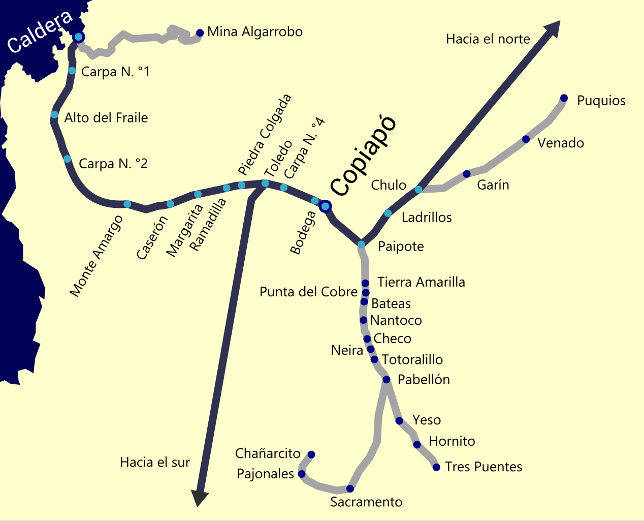
Español: Mapa del ferrocarril de Calera a Copiapó, junto con ramales secundarios y la Red Norte que conecta por Toledo y Paipote.
)Linea azul: ferrocarril existente Linea gris: ferrocarril levantado o sin poder ser utilizado Mapa basado en los planos de 1930 (Mapa de los ferrocarriles de Chile [material cartográfico]. Retrieved on 2018-12-23. |
| Date | |
| Source | Own work |
| Author | LuisCG11 |
Licensing edit
I, the copyright holder of this work, hereby publish it under the following license:
This file is licensed under the Creative Commons Attribution-Share Alike 4.0 International license.
- You are free:
- to share – to copy, distribute and transmit the work
- to remix – to adapt the work
- Under the following conditions:
- attribution – You must give appropriate credit, provide a link to the license, and indicate if changes were made. You may do so in any reasonable manner, but not in any way that suggests the licensor endorses you or your use.
- share alike – If you remix, transform, or build upon the material, you must distribute your contributions under the same or compatible license as the original.
File history
Click on a date/time to view the file as it appeared at that time.
| Date/Time | Thumbnail | Dimensions | User | Comment | |
|---|---|---|---|---|---|
| current | 03:14, 23 December 2018 | | 1,494 × 1,207 (223 KB) | LuisCG11 (talk | contribs) | User created page with UploadWizard |
You cannot overwrite this file.
File usage on Commons
The following 5 pages use this file:
File usage on other wikis
The following other wikis use this file:
- Usage on es.wikipedia.org
- Usage on www.wikidata.org