File:Mapa Terremoto El Salvador 2012.jpg
Size of this preview: 536 × 599 pixels. Other resolutions: 215 × 240 pixels | 612 × 684 pixels.
Original file (612 × 684 pixels, file size: 237 KB, MIME type: image/jpeg)
Captions
Captions
Add a one-line explanation of what this file represents
Summary edit
| Description |
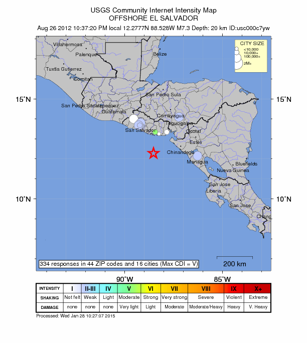
Español: Mapa de intensidad en El Salvador, por el terremoto de 2012. |
|||
| Date | ||||
| Source | https://earthquake.usgs.gov/earthquakes/dyfi/events/us/c000c7yw/us/index.html | |||
| Author | USGS | |||
| Permission (Reusing this file) |
|
File history
Click on a date/time to view the file as it appeared at that time.
| Date/Time | Thumbnail | Dimensions | User | Comment | |
|---|---|---|---|---|---|
| current | 00:10, 14 April 2015 | | 612 × 684 (237 KB) | Oscarter13 (talk | contribs) | User created page with UploadWizard |
You cannot overwrite this file.
File usage on Commons
There are no pages that use this file.