File:Mapa da Geira.jpg
Size of this preview: 800 × 513 pixels. Other resolutions: 320 × 205 pixels | 640 × 411 pixels | 968 × 621 pixels.
Original file (968 × 621 pixels, file size: 118 KB, MIME type: image/jpeg)
Captions
Captions
Add a one-line explanation of what this file represents
Summary edit
| Description |
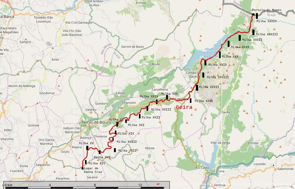
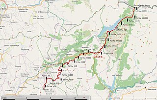
Português: Mapa da Via Nova, Via XVIII do Itinerário de Antonino, ou Geira no concelho de Terras de Bouro e classificada como Monumento Nacional desde 2013
Français : Carte d'une portion de la voie romaine Via Nova ou Voie XVIII ou Geira, classée comme monument national au Portugal. |
| Date | |
| Source | Obra do próprio based on map by OpenStreetMap contributors |
| Author | Xicodaponte |
Licensing edit
I, the copyright holder of this work, hereby publish it under the following license:
This file is licensed under the Creative Commons Attribution-Share Alike 4.0 International license.
- You are free:
- to share – to copy, distribute and transmit the work
- to remix – to adapt the work
- Under the following conditions:
- attribution – You must give appropriate credit, provide a link to the license, and indicate if changes were made. You may do so in any reasonable manner, but not in any way that suggests the licensor endorses you or your use.
- share alike – If you remix, transform, or build upon the material, you must distribute your contributions under the same or compatible license as the original.
File history
Click on a date/time to view the file as it appeared at that time.
| Date/Time | Thumbnail | Dimensions | User | Comment | |
|---|---|---|---|---|---|
| current | 13:22, 10 June 2020 | | 968 × 621 (118 KB) | Xicodaponte (talk | contribs) | Uploaded own work with UploadWizard |
You cannot overwrite this file.
File usage on Commons
There are no pages that use this file.
File usage on other wikis
The following other wikis use this file:
- Usage on fr.wikipedia.org
- Usage on pt.wikipedia.org