File:Mapa de Cabimas.PNG
Size of this preview: 800 × 600 pixels. Other resolutions: 320 × 240 pixels | 640 × 480 pixels | 1,024 × 768 pixels.
Original file (1,024 × 768 pixels, file size: 84 KB, MIME type: image/png)
Captions
Captions
Add a one-line explanation of what this file represents
Summary edit
| Description |
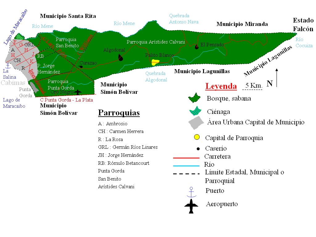
Español: Mapa del Municipio Cabimas, Estado Zulia, Venezuela. English: Map of Cabimas municipality one of the political subdivisions of Zulia state in Venezuela. |
| Date | |
| Source | Own work |
| Author | Andrés González |
Licensing edit
| I, the copyright holder of this work, release this work into the public domain. This applies worldwide. In some countries this may not be legally possible; if so: I grant anyone the right to use this work for any purpose, without any conditions, unless such conditions are required by law. |
File history
Click on a date/time to view the file as it appeared at that time.
| Date/Time | Thumbnail | Dimensions | User | Comment | |
|---|---|---|---|---|---|
| current | 12:32, 20 April 2011 | | 1,024 × 768 (84 KB) | Andrés González (talk | contribs) | Corrigiendo nombres de las parroquias |
| 18:36, 1 April 2009 |  | 860 × 569 (45 KB) | Andrés González (talk | contribs) | {{Information |Description={{es|1=Mapa del Municipio Cabimas, Estado Zulia, Venezuela}} |Source=Own work by uploader |Author=Andrés González |Date=1-4-2009 |Permission= |other_versions= }} <!--{{ImageUpload|full}}--> |
You cannot overwrite this file.
File usage on Commons
There are no pages that use this file.
File usage on other wikis
The following other wikis use this file:
- Usage on es.wikipedia.org