File:Mapa de localización Pichincha.svg

Size of this PNG preview of this SVG file: 800 × 572 pixels. Other resolutions: 320 × 229 pixels | 640 × 458 pixels | 1,024 × 732 pixels | 1,280 × 916 pixels | 2,560 × 1,831 pixels | 959 × 686 pixels.
Original file (SVG file, nominally 959 × 686 pixels, file size: 3.9 MB)
Captions
Captions
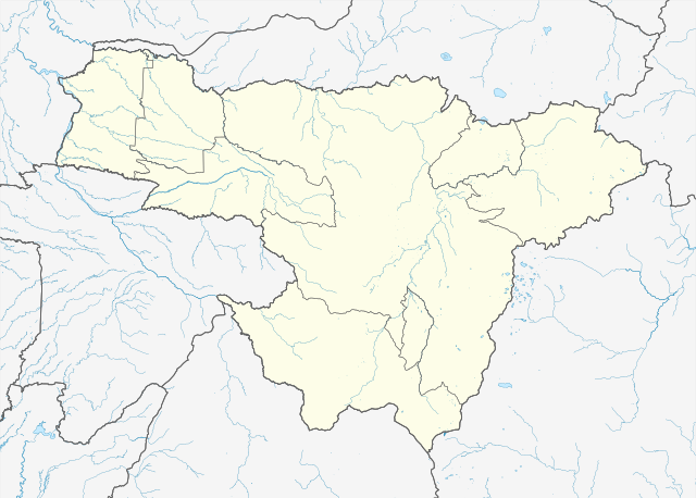
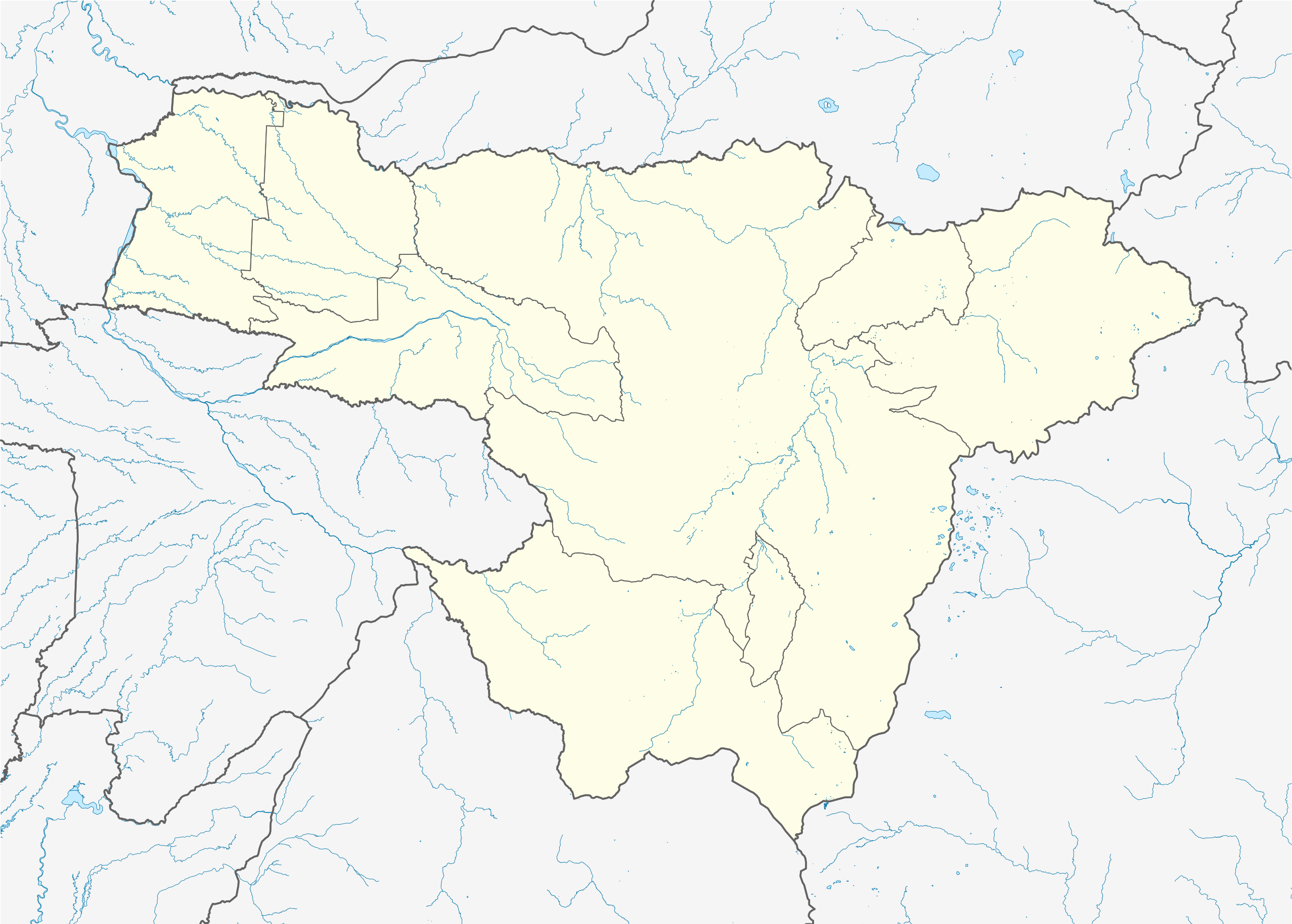
Location map of Pichincha province.
Summary
edit
| Description |
Español: Mapa de localización de la provincia de Pichincha.
Proyección equirectangular. Límites geográficos del mapa:
English: Location map of Pichincha province.
Equirectangular projection. Geographic limits of the map:
|
| Date | |
| Source |
Own work using:
|
| Author | Waterloo1883 |
Licensing
edit
I, the copyright holder of this work, hereby publish it under the following license:
This file is licensed under the Creative Commons Attribution-Share Alike 4.0 International license.
- You are free:
- to share – to copy, distribute and transmit the work
- to remix – to adapt the work
- Under the following conditions:
- attribution – You must give appropriate credit, provide a link to the license, and indicate if changes were made. You may do so in any reasonable manner, but not in any way that suggests the licensor endorses you or your use.
- share alike – If you remix, transform, or build upon the material, you must distribute your contributions under the same or compatible license as the original.
File history
Click on a date/time to view the file as it appeared at that time.
| Date/Time | Thumbnail | Dimensions | User | Comment | |
|---|---|---|---|---|---|
| current | 00:54, 26 January 2024 | | 959 × 686 (3.9 MB) | Waterloo1883 (talk | contribs) | Actualización de los límites de las provincias de Esmeraldas, Santo Domingo de los Tsáchilas y Cotopaxi. |
| 03:46, 13 October 2020 |  | 512 × 367 (2.23 MB) | Waterloo1883 (talk | contribs) | Uploaded own work with UploadWizard |
You cannot overwrite this file.
File usage on Commons
The following page uses this file:
File usage on other wikis
The following other wikis use this file:
- Usage on es.wikipedia.org
- Cayambe (ciudad)
- Batalla de Pichincha
- Pomasqui
- Guayllabamba (parroquia)
- Tabacundo
- Sangolquí
- Reserva geobotánica Pululahua
- Calderón (parroquia)
- Ciudad Mitad del Mundo
- Calacalí
- Puerto Quito
- Wikiproyecto:Ilustración/Taller de Cartografía/Realizaciones/América del Sur
- Mindo
- Machachi
- Pedro Vicente Maldonado (ciudad)
- Plantilla:Mapa de localización de Pichincha
- Segunda Categoría de Pichincha 2021
- Alangasí (parroquia)
- Tababela
- Usage on fr.wikipedia.org
- Usage on os.wikipedia.org