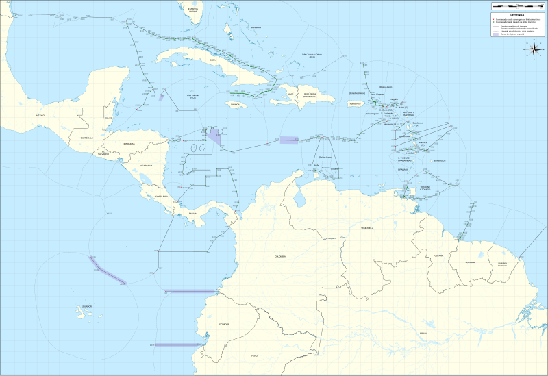
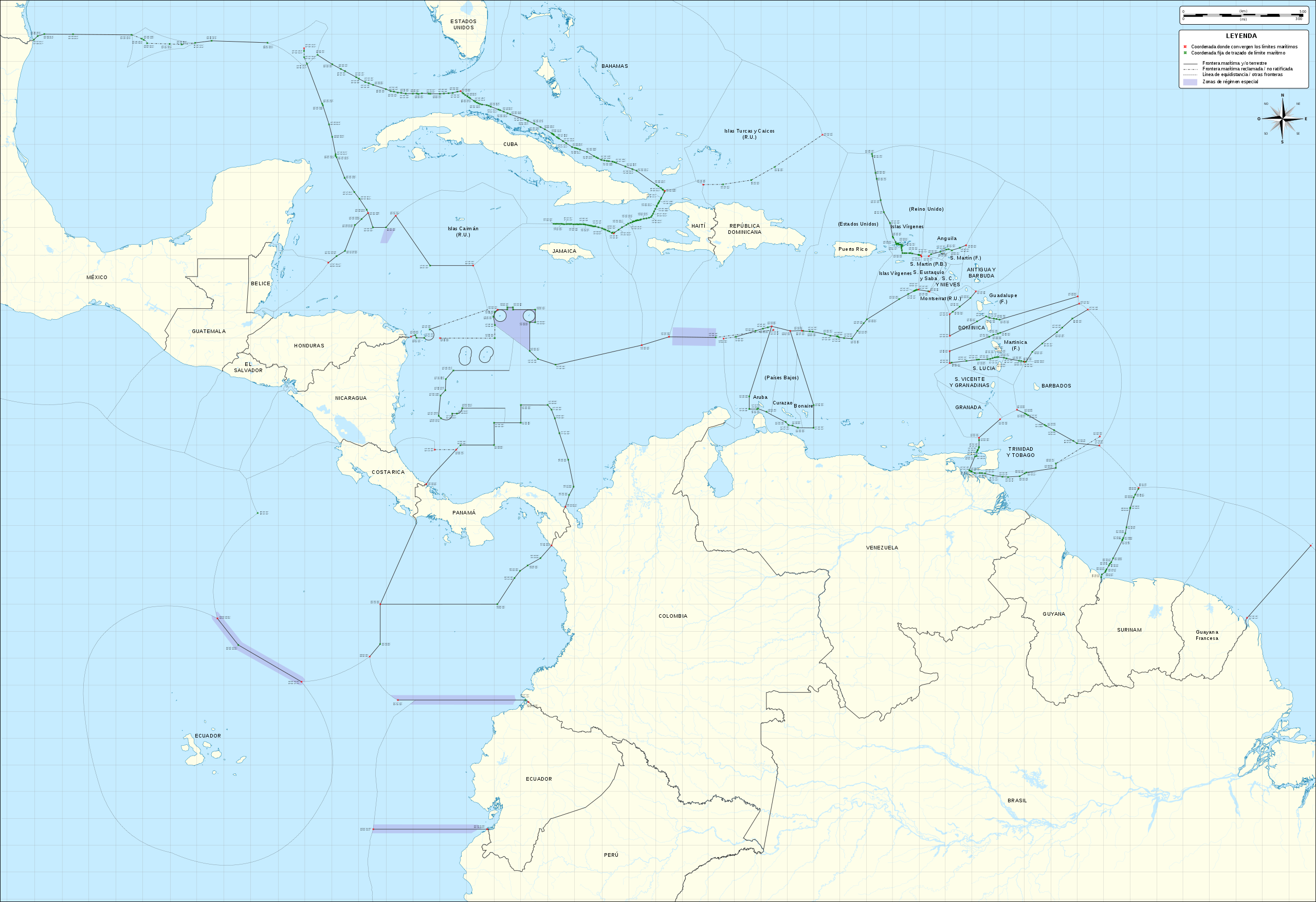
File:Mapa del Caribe (límites marinos).svg

Size of this PNG preview of this SVG file: 800 × 548 pixels. Other resolutions: 320 × 219 pixels | 640 × 439 pixels | 1,024 × 702 pixels | 1,280 × 877 pixels | 2,560 × 1,755 pixels | 5,340 × 3,660 pixels.
Original file (SVG file, nominally 5,340 × 3,660 pixels, file size: 3.02 MB)
Captions
Captions
Add a one-line explanation of what this file represents
Summary edit
.svg)

.png)
.svg)

.svg&action=edit§ion=1)
Licensing edit
.svg&action=edit§ion=2)
I, the copyright holder of this work, hereby publish it under the following license:
This file is licensed under the Creative Commons Attribution-Share Alike 3.0 Unported license.
- You are free:
- to share – to copy, distribute and transmit the work
- to remix – to adapt the work
- Under the following conditions:
- attribution – You must give appropriate credit, provide a link to the license, and indicate if changes were made. You may do so in any reasonable manner, but not in any way that suggests the licensor endorses you or your use.
- share alike – If you remix, transform, or build upon the material, you must distribute your contributions under the same or compatible license as the original.
File history
Click on a date/time to view the file as it appeared at that time.
| Date/Time | Thumbnail | Dimensions | User | Comment | |
|---|---|---|---|---|---|
| current | 05:45, 12 January 2018 | | 5,340 × 3,660 (3.02 MB) | Milenioscuro (talk | contribs) | de vuelta al mapa con la región completa, desde el golfo de México hasta las Guayanas y del mar de Sargazos al de Balboa |
| 16:50, 19 April 2014 |  | 3,561 × 2,221 (2.86 MB) | Milenioscuro (talk | contribs) | fixed legend | |
| 19:48, 15 April 2014 |  | 3,561 × 2,221 (2.78 MB) | Thayts (talk | contribs) | fixed legend dash lines; added S. Martín (P.B.) internal boundary; added "S. Martín (F.)", "S. Eustaquio y Saba (P.B.)", "Aruba (P.B.)", "Curazao (P.B.)", and "Bonaire (P.B.)" labels | |
| 22:24, 11 April 2014 |  | 3,561 × 2,221 (2.86 MB) | Milenioscuro (talk | contribs) | mapa actualizado con todas las fronteras marinas demarcadas por tratados vigentes y con coordenadas | |
| 18:35, 4 February 2014 |  | 3,424 × 2,223 (1.56 MB) | Milenioscuro (talk | contribs) | recorto areas sobrantes y le pongo nombres a los paises | |
| 09:39, 10 January 2013 |  | 5,343 × 3,665 (3.67 MB) | Milenioscuro (talk | contribs) | User created page with UploadWizard |
You cannot overwrite this file.
File usage on Commons
The following 5 pages use this file:
.svg&oldid=837605217)