File:Mapa do Brasil por regiões.PNG

Size of this preview: 563 × 600 pixels. Other resolutions: 225 × 240 pixels | 451 × 480 pixels | 721 × 768 pixels | 1,156 × 1,231 pixels.
Original file (1,156 × 1,231 pixels, file size: 57 KB, MIME type: image/png)
Captions
Captions
Add a one-line explanation of what this file represents
Summary edit
| Description |
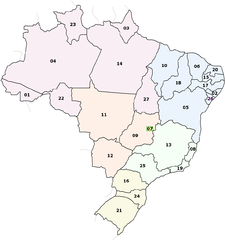
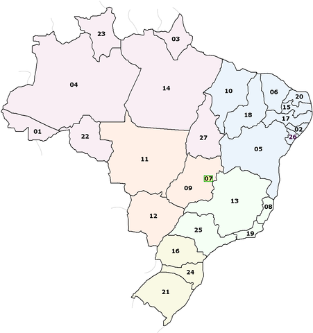
English: Map of Brazil - Regions.
Português: Mapa do Brasil com suas regiões. |
| Date | |
| Source | Own work |
| Author | Guilmann |
| Other versions | Derivative works of this file: Brasil NovosEstados.png |
Pagina em portugues ao lado.
Licensing edit
| I, the copyright holder of this work, release this work into the public domain. This applies worldwide. In some countries this may not be legally possible; if so: I grant anyone the right to use this work for any purpose, without any conditions, unless such conditions are required by law. |
File history
Click on a date/time to view the file as it appeared at that time.
| Date/Time | Thumbnail | Dimensions | User | Comment | |
|---|---|---|---|---|---|
| current | 11:29, 9 February 2009 | | 1,156 × 1,231 (57 KB) | Guilmann (talk | contribs) | ({{Information |Description={{en|1=Map of Brazil - Regions.}} {{pt|1=Mapa do Brasil com suas regiões.}} |Source=Trabalho próprio |Author=Guilmann |Date=08 de fevereiro de 2009. |Permission= |other_versions= }} <!--{{ImageUpload|full}}-->) |
| 16:41, 8 February 2009 |  | 1,156 × 1,231 (56 KB) | Guilmann (talk | contribs) | {{Information |Description={{en|1=Map of Brazil - Regions.}} {{pt|1=Mapa do Brasil com suas regiões.}} |Source=Trabalho próprio |Author=Guilmann |Date=08 de fevereiro de 2009. |Permission= |other_versions= }} <!--{{ImageUpload|full}} |
You cannot overwrite this file.
File usage on Commons
There are no pages that use this file.
File usage on other wikis
The following other wikis use this file:
- Usage on en.wikipedia.org
- Usage on es.wikipedia.org
- Usage on fr.wikipedia.org
- Usage on it.wikipedia.org
- Usage on ja.wikipedia.org