File:Mapa powiatów województwa podlaskiego.png
Size of this preview: 411 × 600 pixels. Other resolutions: 164 × 240 pixels | 329 × 480 pixels | 526 × 768 pixels | 701 × 1,024 pixels | 1,403 × 2,048 pixels | 4,928 × 7,194 pixels.
Original file (4,928 × 7,194 pixels, file size: 702 KB, MIME type: image/png)
Captions
Captions
Add a one-line explanation of what this file represents
Summary edit
| Description |
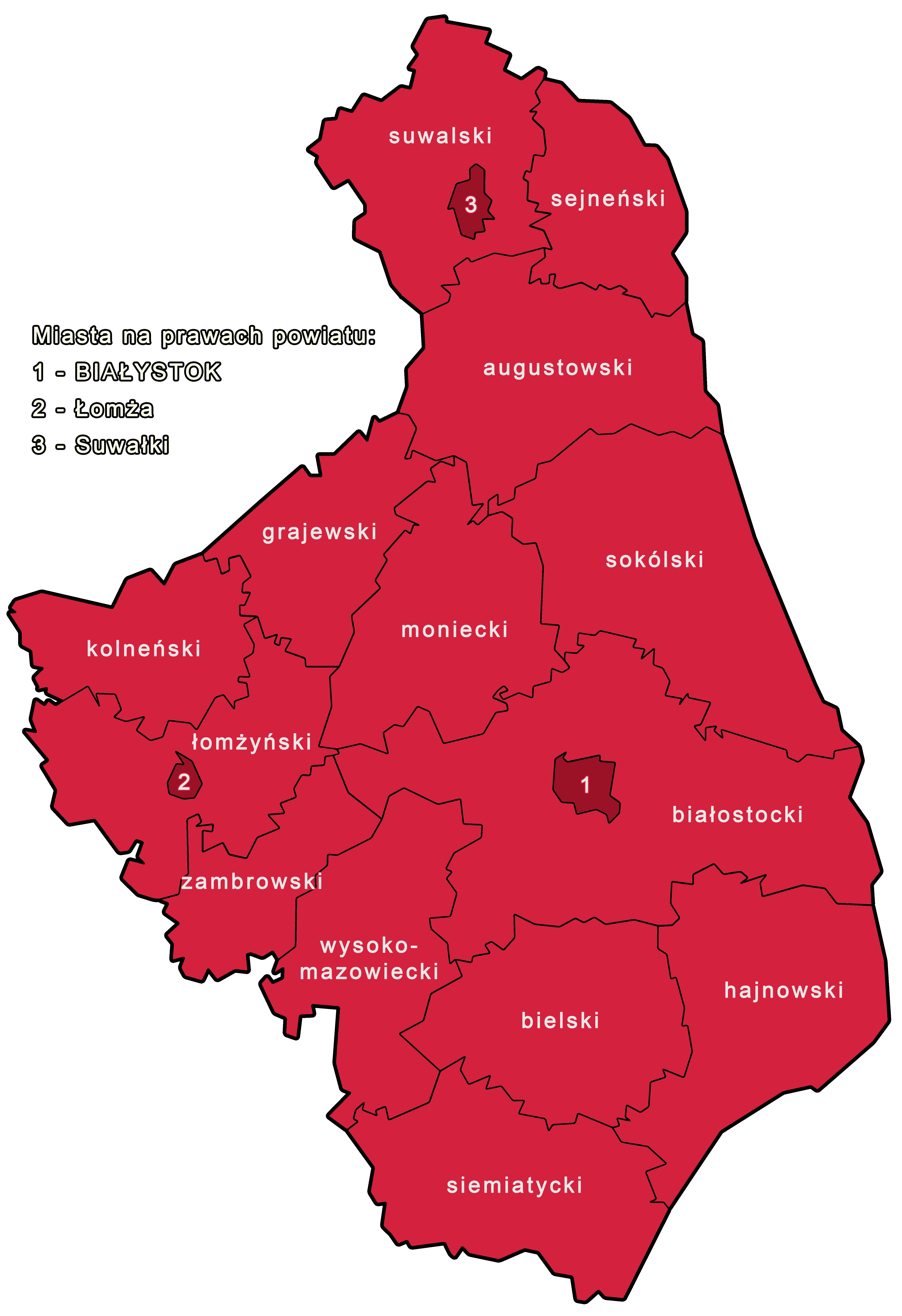
Polski: Mapa powiatów województwa podlaskiego. Seria spójnych grafik mających zastąpić dotychczasowe. Pokolorowane w barwach narodowych. |
| Date | |
| Source | Own work |
| Author | Piotr Chojnacki |
Licensing edit
I, the copyright holder of this work, hereby publish it under the following license:
This file is licensed under the Creative Commons Attribution-Share Alike 4.0 International license.
- You are free:
- to share – to copy, distribute and transmit the work
- to remix – to adapt the work
- Under the following conditions:
- attribution – You must give appropriate credit, provide a link to the license, and indicate if changes were made. You may do so in any reasonable manner, but not in any way that suggests the licensor endorses you or your use.
- share alike – If you remix, transform, or build upon the material, you must distribute your contributions under the same or compatible license as the original.
File history
Click on a date/time to view the file as it appeared at that time.
| Date/Time | Thumbnail | Dimensions | User | Comment | |
|---|---|---|---|---|---|
| current | 02:55, 30 October 2018 | | 4,928 × 7,194 (702 KB) | Risen911 (talk | contribs) | Moved city names to side as they would have problems to fit in different voivodships. Changed map border to black. |
| 19:00, 29 October 2018 |  | 4,928 × 7,194 (538 KB) | Risen911 (talk | contribs) | User created page with UploadWizard |
You cannot overwrite this file.
File usage on Commons
There are no pages that use this file.