File:Mapping flood with Envisat's radar.jpg
Size of this preview: 410 × 599 pixels. Other resolutions: 164 × 240 pixels | 329 × 480 pixels | 789 × 1,152 pixels.
Original file (789 × 1,152 pixels, file size: 233 KB, MIME type: image/jpeg)
Captions
Captions
Add a one-line explanation of what this file represents
Summary edit
| Mapping flood with Envisat's radar | |
|---|---|
| Photographer |
Envisat satellite |
| Title |
Mapping flood with Envisat's radar |
| Description |
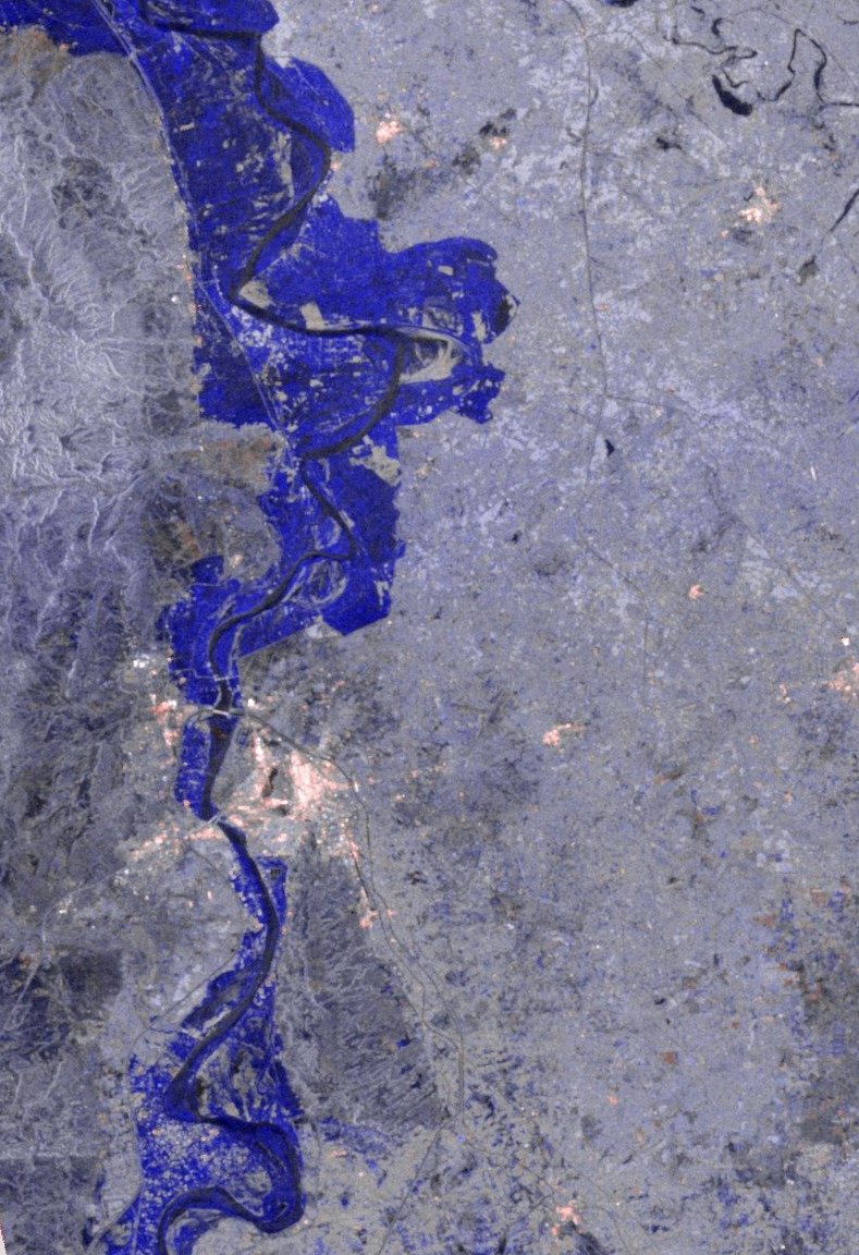
English: This image shows a 100×500 km strip of the flood area in Pakistan. The image was generated from all-weather ESA's Envisat Advanced Synthetic Aperture Radar (ASAR). The image illustrates the difference between 24 August and a reference image of 8 September 2009. The areas shown in blue are inundated regions. |
| Depicted place | Pakistan |
| Date | between 24 August 2009 and 8 September 2009 |
| Collection | European Space Agency |
| Accession number |
235858 |
| Credit line | ESA |
| Source | http://www.esa.int/spaceinimages/Images/2010/08/Mapping_flood_with_Envisat_s_radar |
Licensing edit
This file is licensed under the Creative Commons Attribution-ShareAlike 3.0 IGO license.
- You are free:
- to share – to copy, distribute and transmit the work
- to remix – to adapt the work
- Under the following conditions:
- attribution – You must give appropriate credit, provide a link to the license, and indicate if changes were made. You may do so in any reasonable manner, but not in any way that suggests the licensor endorses you or your use.
- share alike – If you remix, transform, or build upon the material, you must distribute your contributions under the same or compatible license as the original.
File history
Click on a date/time to view the file as it appeared at that time.
| Date/Time | Thumbnail | Dimensions | User | Comment | |
|---|---|---|---|---|---|
| current | 10:32, 25 February 2017 | | 789 × 1,152 (233 KB) | Revent (talk | contribs) | =={{int:filedesc}}== {{Photograph |photographer = Envisat satellite |title = Mapping flood with Envisat's radar |description = {{en|1=This image shows a 100×500 km strip of the flood area in Pakistan. The image was generat... |
You cannot overwrite this file.
File usage on Commons
The following 3 pages use this file: