File:MarsCuriosityRover-TraverseMap-Sol0581-20140326.jpg

Size of this preview: 776 × 600 pixels. Other resolutions: 311 × 240 pixels | 621 × 480 pixels | 994 × 768 pixels | 1,280 × 989 pixels | 2,560 × 1,978 pixels | 3,300 × 2,550 pixels.
Original file (3,300 × 2,550 pixels, file size: 1.4 MB, MIME type: image/jpeg)
Captions
Captions
Add a one-line explanation of what this file represents
Summary edit
| Description |
English: 03.26.2014
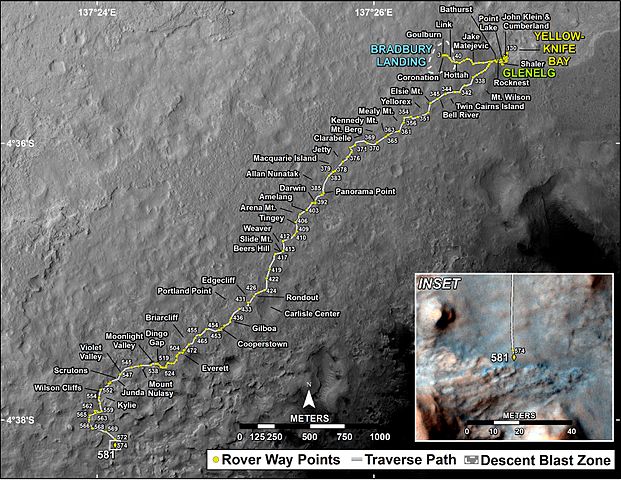
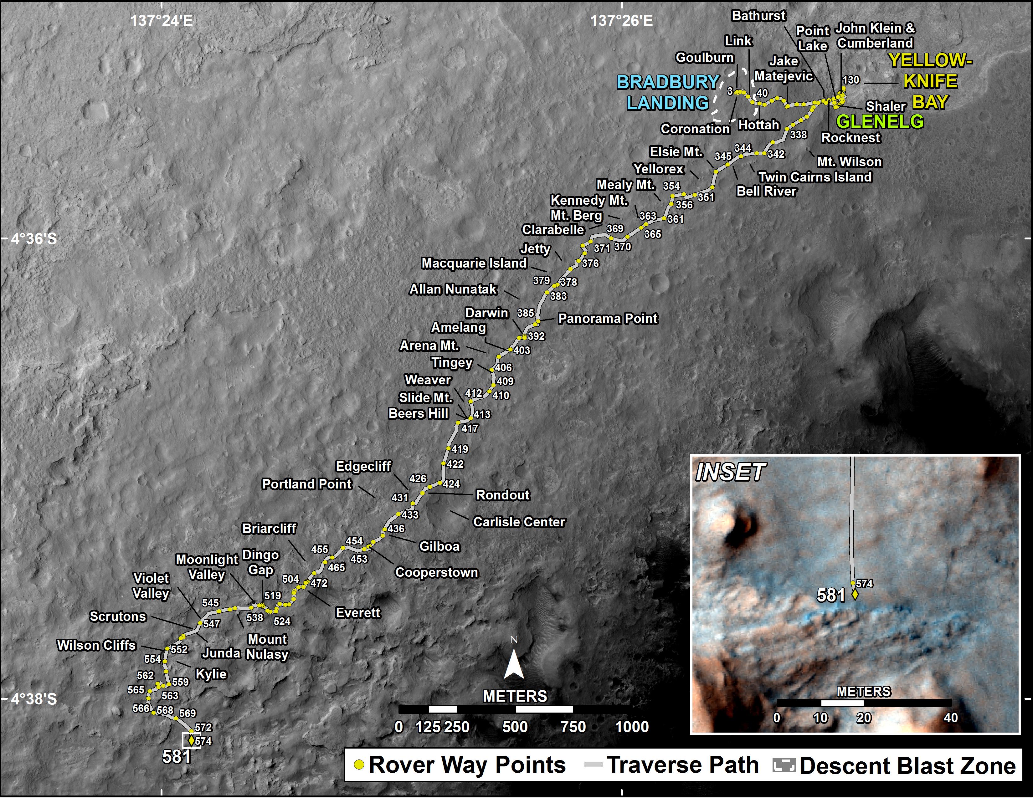
Curiosity's Traverse Map Through Sol 581 http://mars.jpl.nasa.gov/msl/multimedia/images/?ImageID=6103 This map shows the route driven by NASA's Mars rover Curiosity through the 581 Martian day, or sol, of the rover's mission on Mars (March 26, 2014). Numbering of the dots along the line indicate the sol number of each drive. North is up. The scale bar is 1 kilometer (~0.62 mile). From Sol 574 to Sol 581, Curiosity had driven a straight line distance of about 9.06 feet (2.76 meters). The base image from the map is from the High Resolution Imaging Science Experiment Camera (HiRISE) in NASA's Mars Reconnaissance Orbiter. |
| Date | |
| Source | http://mars.jpl.nasa.gov/msl/images/MSL_TraverseMap_Sol0581-full.jpg |
| Author | NASA/JPL-Caltech/Univ. of Arizona |
Licensing edit
| This file is in the public domain in the United States because it was solely created by NASA. NASA copyright policy states that "NASA material is not protected by copyright unless noted". (See Template:PD-USGov, NASA copyright policy page or JPL Image Use Policy.) | ||
 |
Warnings:
|
File history
Click on a date/time to view the file as it appeared at that time.
| Date/Time | Thumbnail | Dimensions | User | Comment | |
|---|---|---|---|---|---|
| current | 17:32, 1 April 2014 | | 3,300 × 2,550 (1.4 MB) | Drbogdan (talk | contribs) | User created page with UploadWizard |
You cannot overwrite this file.
File usage on Commons
The following page uses this file: