File:Mars Odyssey All Stars -- Arabia Dunes DVIDS852080.jpg
Size of this preview: 658 × 600 pixels. Other resolutions: 263 × 240 pixels | 527 × 480 pixels | 843 × 768 pixels | 1,123 × 1,024 pixels | 2,092 × 1,907 pixels.
Original file (2,092 × 1,907 pixels, file size: 1.27 MB, MIME type: image/jpeg)
Captions
Captions
Add a one-line explanation of what this file represents
Summary edit
| Description |
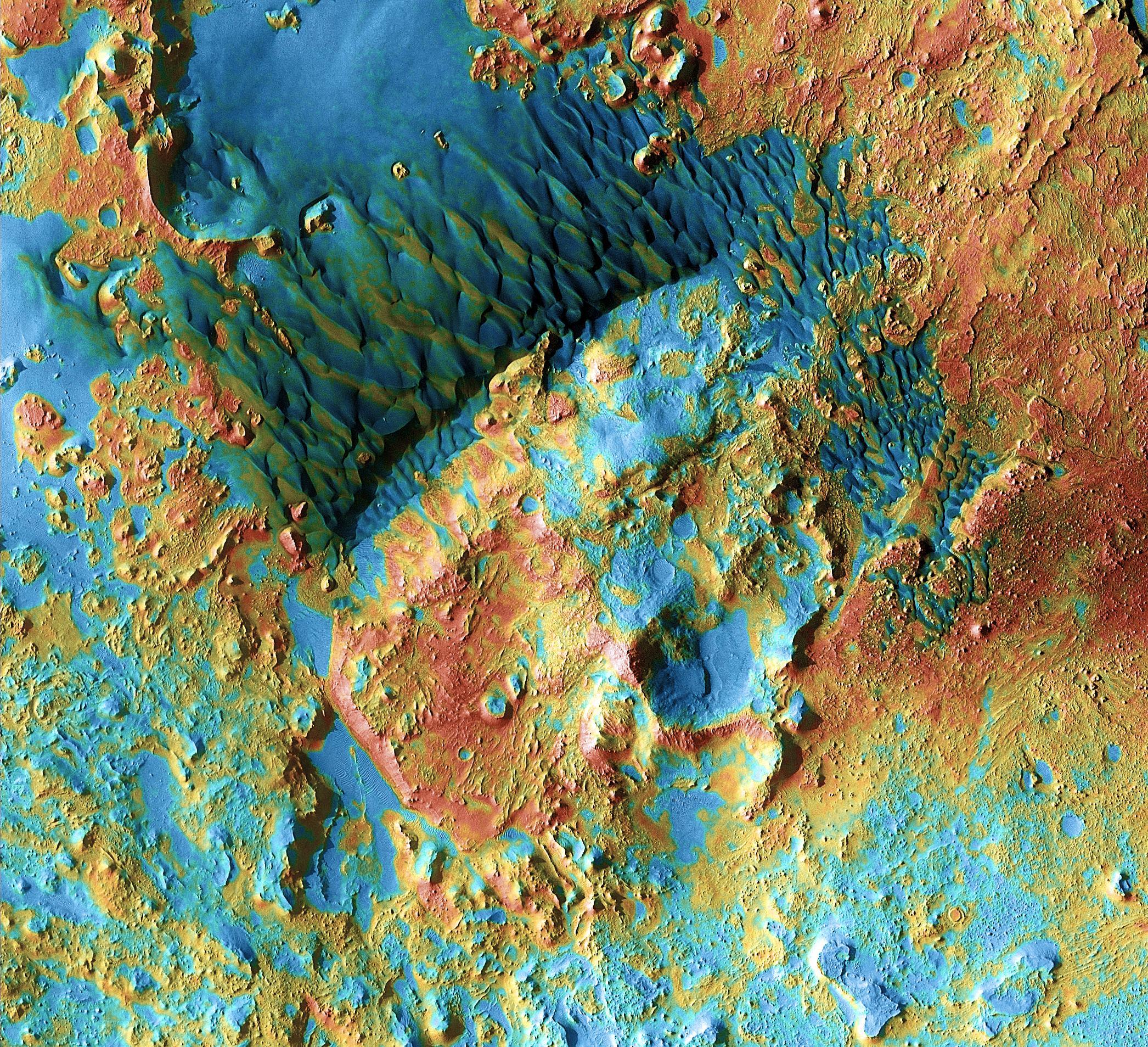
English: Sand dunes shaped like blue-black flames lie next to a central hill within an unnamed, 120-kilometer-wide (75-mile-wide) crater in eastern Arabia on Mars. False colors depict the nature of the ground surface: Areas in bluish tints have more fine sand at the surface, while redder tints indicate harder sediments and outcrops of rock. This scene combines images taken during the period from February 2003 to August 2004 by the Thermal Emission Imaging System instrument on NASA's Mars Odyssey orbiter. It is part of a special set of images marking the occasion of Odyssey becoming the longest-working Mars spacecraft in history. The pictured location on Mars is 26.7 degrees north latitude, 63 degrees east longitude. NASA's Jet Propulsion Laboratory manages the 2001 Mars Odyssey mission for NASA's Science Mission Directorate, Washington, D.C. The Thermal Emission Imaging System (THEMIS) was developed by Arizona State University, Tempe, in collaboration with Raytheon Santa Barbara Remote Sensing. The THEMIS investigation is led by Dr. Philip Christensen at Arizona State University. Lockheed Martin Astronautics, Denver, is the prime contractor for the Odyssey project, and developed and built the orbiter. Mission operations are conducted jointly from Lockheed Martin and from JPL, a division of the California Institute of Technology in Pasadena. Image credit: NASA/JPL-Caltech/ASU
NASA Identifier: 504660main_pia13658 |
| Date | |
| Source | https://www.dvidshub.net/image/852080 |
| Author | Glenn Research Center |
| Location | WASHINGTON, D.C., US |
| Posted | 8 February 2013, 15:32 |
| DVIDS ID | 852080 |
| Archive link | archive copy at the Wayback Machine |
Licensing edit
This image is a work of a U.S. military or Department of Defense employee, taken or made as part of that person's official duties. As a work of the U.S. federal government, the image is in the public domain in the United States.
|
 |
File history
Click on a date/time to view the file as it appeared at that time.
| Date/Time | Thumbnail | Dimensions | User | Comment | |
|---|---|---|---|---|---|
| current | 23:00, 5 March 2015 | | 2,092 × 1,907 (1.27 MB) | Fæ (talk | contribs) | == {{int:filedesc}} == {{milim | description = {{en|1=Sand dunes shaped like blue-black flames lie next to a central hill within an unnamed, 120-kilometer-wide (75-mile-wide) crater in eastern Arabia on Mars. False colors depict the nature of the groun... |
You cannot overwrite this file.
File usage on Commons
There are no pages that use this file.