File:Marstrand1709-01.jpg
Original file (3,508 × 2,168 pixels, file size: 1.17 MB, MIME type: image/jpeg)
Captions
Captions
Summary edit
| Description |
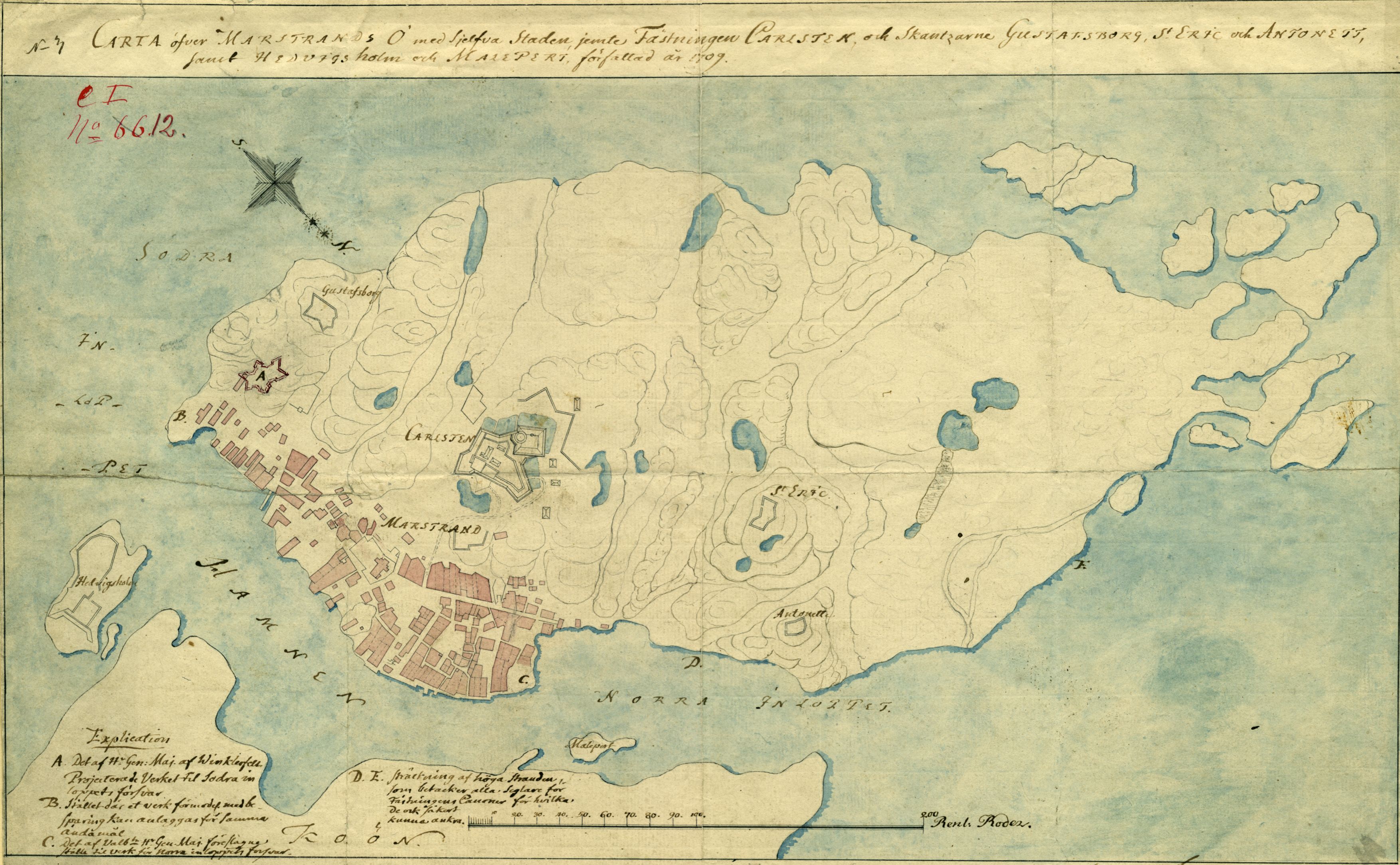
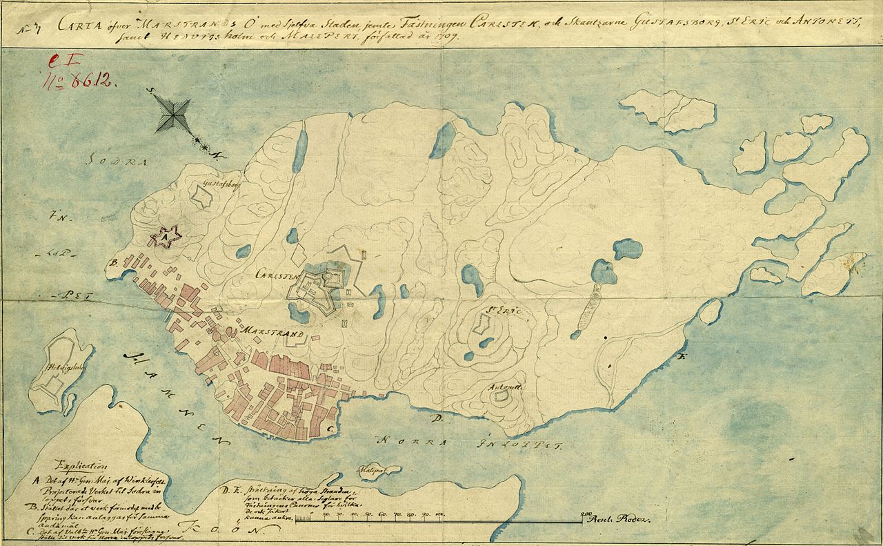
Deutsch: Karte, die die bestehenden und geplanten Befestigungen um die schwedische Festung Carlsten, und Stadt Marstrand, in Schweden 1709 zeigt. Die Karte ist eine Kopie von 1779.
English: Map showing the fortifications, also planned, around the Swedish fortress Karlsten, and town Marstrand, in Sweden 1709. The map is a copy from 1779.
Svenska: Karta över befintliga och planerade försvarsanläggningar omkring Karlsten och Marstrand 1709. Kartan är en kopia från 1779. |
| Date | (copy 1779) |
| Source | Krigsarkivet: Sverige Stads och fästningsplaner, Marstrand: 0424:099:405e |
| Author | Fr J Nordencreutz |
Licensing edit
|
This work is in the public domain in its country of origin and other countries and areas where the copyright term is the author's life plus 70 years or fewer.
| |
| This file has been identified as being free of known restrictions under copyright law, including all related and neighboring rights. | |
File history
Click on a date/time to view the file as it appeared at that time.
| Date/Time | Thumbnail | Dimensions | User | Comment | |
|---|---|---|---|---|---|
| current | 09:52, 1 March 2014 | | 3,508 × 2,168 (1.17 MB) | Dagjoh (talk | contribs) | {{Information |Description ={{en|1=Map showing the fortifications, also planned, around the Swedish fortress Karlsten, and town Marstrand, in Sweden 1709.}} {{sv|1=Karta över befintliga och planerade försvarsanläggningar omkring Karlsten och Mars... |
You cannot overwrite this file.
File usage on Commons
There are no pages that use this file.
File usage on other wikis
The following other wikis use this file:
- Usage on da.wikipedia.org
- Usage on en.wikipedia.org
- Usage on sv.wikipedia.org