File:Maug islands dike.jpg

Size of this preview: 450 × 600 pixels. Other resolutions: 180 × 240 pixels | 360 × 480 pixels | 576 × 768 pixels | 768 × 1,024 pixels | 1,688 × 2,250 pixels.
Original file (1,688 × 2,250 pixels, file size: 1 MB, MIME type: image/jpeg)
Captions
Captions
Add a one-line explanation of what this file represents
Summary edit
| Description |
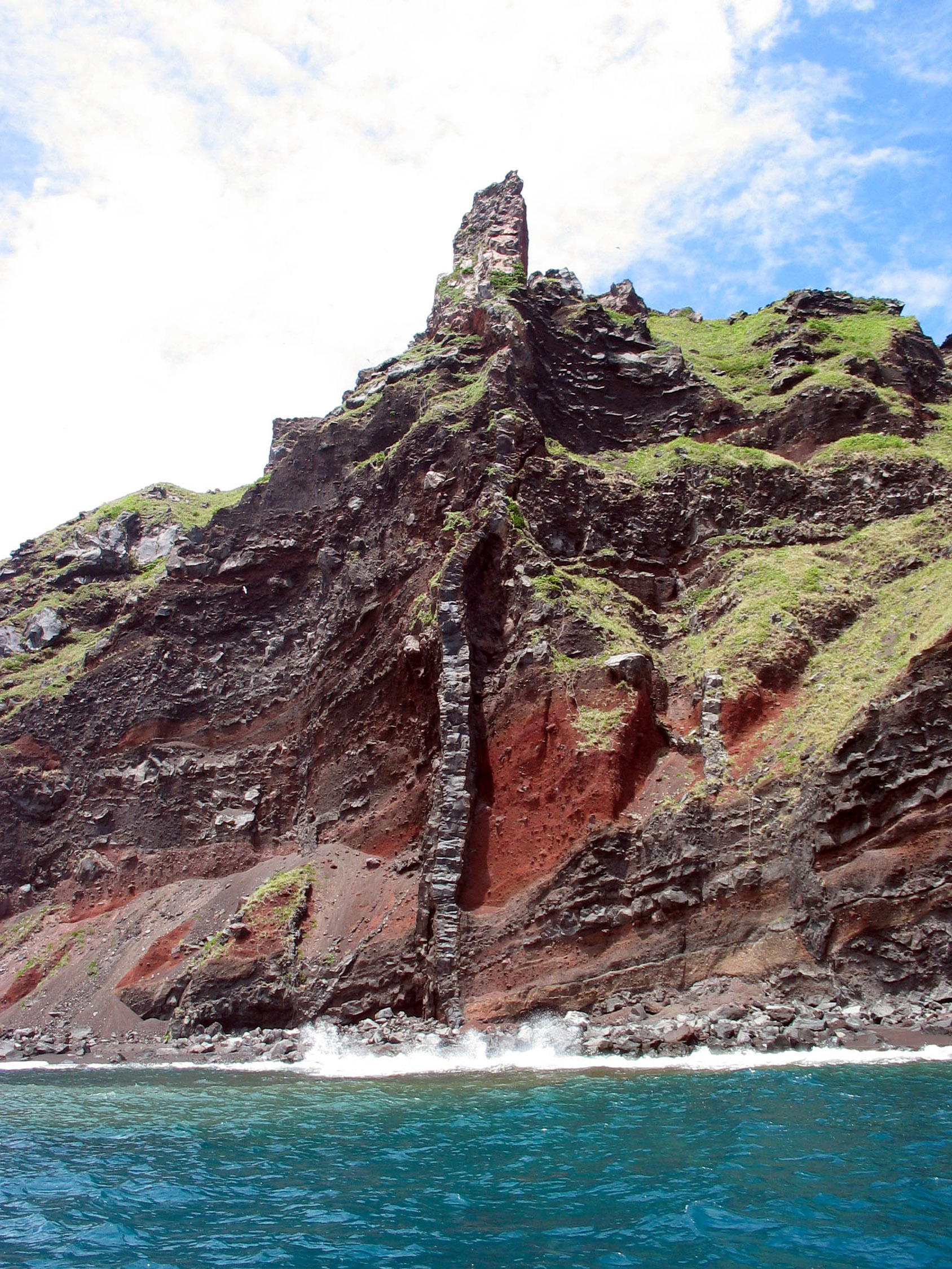
English: The vertical column in the center of the image, called a dike, rises from below sea level to the pinnacle at the top of the ridge. Interlaid massive lavas (darker horizontal bands) and ash-rich lava units (reddish) are also exposed on the islets of Maug. |
| Date | |
| Source | http://oceanexplorer.noaa.gov/explorations/04fire/logs/hirez/dike_maug_hirez.jpg |
| Author | NOAA |
Licensing edit
This image is in the public domain because it contains materials that originally came from the U.S. National Oceanic and Atmospheric Administration, taken or made as part of an employee's official duties.
|
File history
Click on a date/time to view the file as it appeared at that time.
| Date/Time | Thumbnail | Dimensions | User | Comment | |
|---|---|---|---|---|---|
| current | 05:22, 28 February 2008 | | 1,688 × 2,250 (1 MB) | Peko (talk | contribs) | {{Information |Description=The vertical column in the center of the image, called a dike, rises from below sea level to the pinnacle at the top of the ridge. Interlaid massive lavas (darker horizontal bands) and ash-rich lava units (reddish) are also expo |
You cannot overwrite this file.
File usage on Commons
There are no pages that use this file.
File usage on other wikis
The following other wikis use this file:
- Usage on it.wikibooks.org
- Usage on sk.wikipedia.org