File:Mavericks bathymetry.tiff

Size of this JPG preview of this TIF file: 463 × 600 pixels. Other resolutions: 185 × 240 pixels | 371 × 480 pixels | 593 × 768 pixels | 1,275 × 1,651 pixels.
Original file (1,275 × 1,651 pixels, file size: 6.02 MB, MIME type: image/tiff)
Captions
Captions
Add a one-line explanation of what this file represents
Summary edit
| Description |
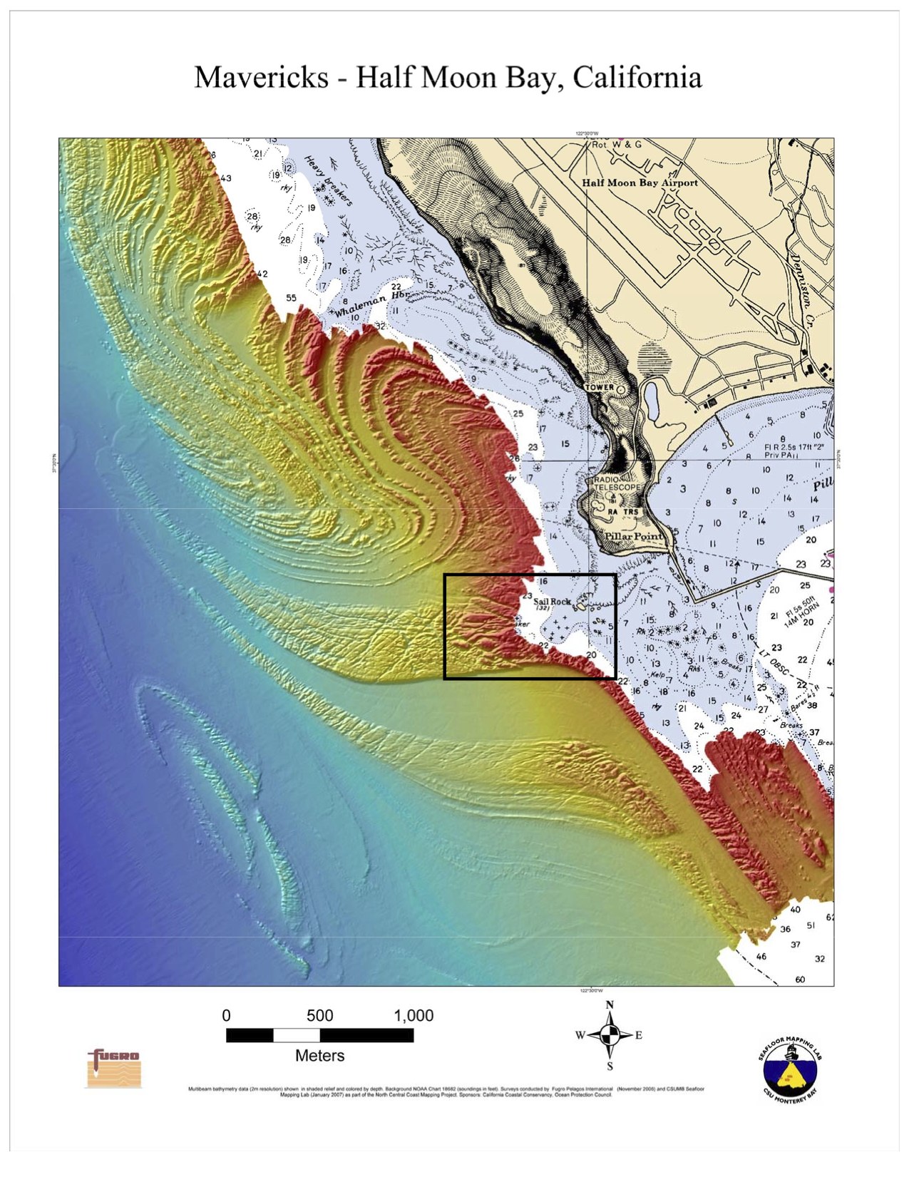
English: Bathymetry off Half Moon Bay, California. Rectangle indicates the location of the Mavericks surf break. |
| Date | |
| Source | Image here, description here, including statement that this is public domain. |
| Author | NOAA |
| Other versions | Derivative works of this file: Mavericks bathymetry - cropped.jpg |
| Camera location | | View this and other nearby images on: OpenStreetMap |
|---|
Licensing edit
This image is in the public domain because it contains materials that originally came from the U.S. National Oceanic and Atmospheric Administration, taken or made as part of an employee's official duties.
|
File history
Click on a date/time to view the file as it appeared at that time.
| Date/Time | Thumbnail | Dimensions | User | Comment | |
|---|---|---|---|---|---|
| current | 01:18, 15 February 2010 |  | 1,275 × 1,651 (6.02 MB) | Avenue (talk | contribs) | {{Information |Description={{en|1=Bathymetry off Half Moon Bay, California. Rectangle indicates the location of the Maverick surf break.}} |Source=Image [http://sanctuaries.noaa.gov/jointplan/presskit/mb/map_mav_bathy.pdf here], description [http://sanctu |
You cannot overwrite this file.
File usage on Commons
The following page uses this file:
File usage on other wikis
The following other wikis use this file:
- Usage on tr.wikipedia.org