File:Maximal Rustamid Extent (9th Century).png
Size of this preview: 800 × 473 pixels. Other resolutions: 320 × 189 pixels | 640 × 379 pixels | 1,024 × 606 pixels | 1,599 × 946 pixels.
Original file (1,599 × 946 pixels, file size: 130 KB, MIME type: image/png)
Captions
Captions
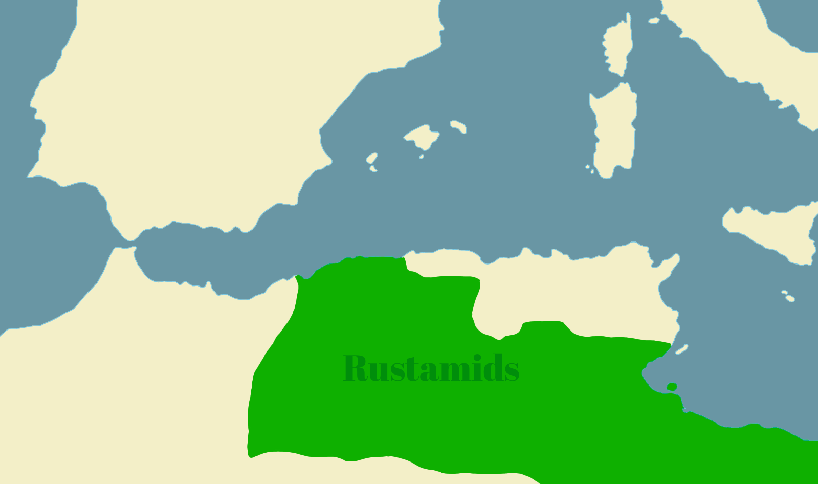
Map of the Rustamid Imamate
Summary edit
.png&action=edit§ion=1)
| Description |
English: The Map is traced from an older map. Made in 1987 in the book of al-Hariri. |
| Date | |
| Source | Own work |
| Author | ⵟⵓⵔⴽⵉⵙⵀⴽⴰⴱⵢⵍ |
Licensing edit
.png&action=edit§ion=2)
I, the copyright holder of this work, hereby publish it under the following license:
This file is licensed under the Creative Commons Attribution-Share Alike 4.0 International license.
- You are free:
- to share – to copy, distribute and transmit the work
- to remix – to adapt the work
- Under the following conditions:
- attribution – You must give appropriate credit, provide a link to the license, and indicate if changes were made. You may do so in any reasonable manner, but not in any way that suggests the licensor endorses you or your use.
- share alike – If you remix, transform, or build upon the material, you must distribute your contributions under the same or compatible license as the original.
File history
Click on a date/time to view the file as it appeared at that time.
| Date/Time | Thumbnail | Dimensions | User | Comment | |
|---|---|---|---|---|---|
| current | 19:40, 1 May 2024 | | 1,599 × 946 (130 KB) | ⵟⵓⵔⴽⵉⵙⵀⴽⴰⴱⵢⵍ (talk | contribs) | Uploaded own work with UploadWizard |
You cannot overwrite this file.
File usage on Commons
There are no pages that use this file.
File usage on other wikis
The following other wikis use this file:
- Usage on fr.wikipedia.org
.png&oldid=872923870)