File:Mecklenburg County North Carolina Incorporated and Unincorporated areas Charlotte highlighted.svg

Size of this PNG preview of this SVG file: 680 × 600 pixels. Other resolutions: 272 × 240 pixels | 544 × 480 pixels | 871 × 768 pixels | 1,161 × 1,024 pixels | 2,322 × 2,048 pixels | 847 × 747 pixels.
Original file (SVG file, nominally 847 × 747 pixels, file size: 199 KB)
Captions
Captions
Add a one-line explanation of what this file represents
Summary edit
| Description |
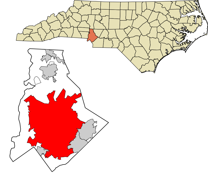
English: Map of Mecklenburg County, North Carolina, highlighting Charlotte |
| Date | |
| Source | Own work |
| Author | Rcsprinter123 |
Licensing edit
I, the copyright holder of this work, hereby publish it under the following license:
This file is licensed under the Creative Commons Attribution-Share Alike 3.0 Unported license.
- You are free:
- to share – to copy, distribute and transmit the work
- to remix – to adapt the work
- Under the following conditions:
- attribution – You must give appropriate credit, provide a link to the license, and indicate if changes were made. You may do so in any reasonable manner, but not in any way that suggests the licensor endorses you or your use.
- share alike – If you remix, transform, or build upon the material, you must distribute your contributions under the same or compatible license as the original.
File history
Click on a date/time to view the file as it appeared at that time.
| Date/Time | Thumbnail | Dimensions | User | Comment | |
|---|---|---|---|---|---|
| current | 16:41, 24 January 2014 | | 847 × 747 (199 KB) | Rcsprinter123 (talk | contribs) | =={{int:filedesc}}== {{Information |description={{en|1=Map of Mecklenburg County, North Carolina, highlighting Charlotte}} |date=2014-12-24 11:43:34 |source={{own}} |author=Rcsprinter123 |permission= |other_versions= |other_field... |
You cannot overwrite this file.
File usage on Commons
The following 8 pages use this file:
- Category:Births in Charlotte, North Carolina
- Category:Charlotte, North Carolina
- Category:Companies based in Charlotte, North Carolina
- Category:Deaths in Charlotte, North Carolina
- Category:Events in Charlotte, North Carolina
- Category:Geography of Charlotte, North Carolina
- Category:Maps of Charlotte, North Carolina
- Category:Neighborhoods in Charlotte, North Carolina
File usage on other wikis
The following other wikis use this file:
- Usage on af.wikipedia.org
- Usage on ang.wikipedia.org
- Usage on ar.wikipedia.org
- Usage on arz.wikipedia.org
- Usage on ast.wikipedia.org
- Usage on ba.wikipedia.org
- Usage on bn.wikipedia.org
- Usage on ca.wikipedia.org
- Usage on ceb.wikipedia.org
- Usage on el.wikipedia.org
- Usage on en.wikipedia.org
- Usage on eo.wikipedia.org
- Usage on eu.wikipedia.org
- Usage on fi.wikipedia.org
- Usage on fr.wikipedia.org
- Usage on ga.wikipedia.org
- Usage on gl.wikipedia.org
- Usage on he.wikipedia.org
- Usage on hu.wikipedia.org
- Usage on ia.wikipedia.org
- Usage on id.wikipedia.org
- Usage on ja.wikipedia.org
- Usage on ku.wikipedia.org
- Usage on la.wikipedia.org
- Usage on nl.wikipedia.org
- Usage on pa.wikipedia.org
- Usage on pt.wikipedia.org
- Usage on sc.wikipedia.org
- Usage on sk.wikipedia.org
- Usage on tt.wikipedia.org
- Usage on ur.wikipedia.org
- Usage on vo.wikipedia.org
- Usage on www.wikidata.org